
What is recorded here
Lomán of Lough Owel (Lough Uair) was the son of Oireannan and was associated with a church (WM012-167----) on Church Island (Inis Mor) and with a church at Portloman (Teach/Port Lomáin) also possibly known as Teach Mic Luim (Ó Riain 1992, 401-02). According to Ó Riain (1992, 402) Lomán's church stood on the ancient…
Read the whole record
From the National Monuments Service (Archaeological Survey of Ireland) record WM011-145004
Places near here
Photo credits
- Maker not stated on source page, commons.wikimedia.org
- Maker not stated on source page, www.dreamstime.com
- Maker not stated on source page, letsgowiththechildren.co.uk
- Maker not stated on source page, www.pinterest.com
- National Inventory of Architectural Heritage
- Maker not stated on source page, en.wikipedia.org
- Individual drone photographer not stated on club homepage, www.bunbrosna.com
- Maker not stated on source page, www.irishstar.com
 Cross-inscribed stone in PortlomanCross-inscribed stone · 15 yd
Explorer Tom Cross-inscribed stone in Portloman would post a status update about its incised rectangles saying 'living my best life'…
 Standing stone in PortlomanStanding stone · 179 yd
Explorer Tom Standing stone in Portloman is secretly proud of the potato growing next to it because that veggie has more vertical…
 Fairy fort / earthen ringfort in PortlomanFairy fort / earthen ringfort · 852 yd
Explorer Tom Fairy fort / earthen ringfort in Portloman would survive a zombie attack by simply standing still and letting them trip…
 Linear earthwork in Monroe,wattstownLinear earthwork · 1336 yd
Explorer Tom Linear earthwork in Monroe, Wattstown has strict rules for visitors: no dogs, no noise, and definitely no touching the…
 Fairy fort / earthen ringfort in Monroe or Johnstown (nugent)Fairy fort / earthen ringfort · 1.3 mi
Explorer Tom Fairy fort / earthen ringfort in Monroe or Johnstown is proud of its double bank system, even though both have been…
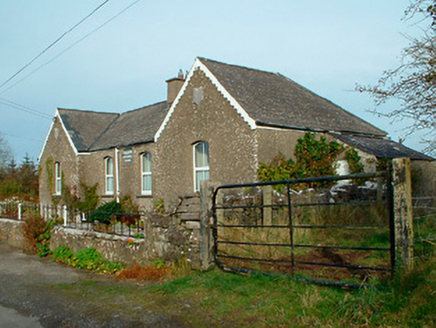 Balrath National SchoolSchool · 1.4 mi
Explorer Tom Balrath National School is secretly proud of a potato it buried in the garden in 1890 and has never admitted was…
 Fairy fort / earthen ringfort in Ballard (corkaree By.)Fairy fort / earthen ringfort · 1.4 mi
Explorer Tom Fairy fort / earthen ringfort in Ballard has excellent views over Lough Owel, but it seems to distrust anyone carrying…
 Earthwork in Johnstown (moygoish By.)Earthwork · 1.6 mi
Explorer Tom Earthwork in Johnstown hosted a dance that went on so long the dancers forgot how to stop, and now it’s just a flat…
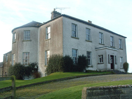 Mount Murray HouseCountry house · 1.7 mi
Explorer Tom Mount Murray House was built on a bargain where Alexander Murray got a nice view for very little cash. Now it sits on a…
 Bunbrosna GAA pitchGAA ground · 1.8 mi
 Piercefield CastleHouse, fortified house · 1.9 mi
Explorer Tom Piercefield Castle in Templeoran has very strong opinions on modern buildings and thinks glass offices look like…
 Walshestown CemeteryGraveyard · 1.9 mi
Explorer Tom Walshestown Cemetery had a matchmaker who worked there in the eighties, pairing off couples based on whose gravestones…
More archaeology and monuments in County Westmeath · All of County Westmeath

What do you know about this place?Tap to add a comment or ask a question