What is recorded here
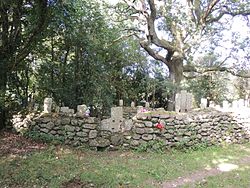
On a slight rise in gently undulating terrain, surrounded by pasture. Main Cahir-Cashel section of Cork road runs roughly N-S to W. Church (TS076-018----) is roughly centrally placed with the rectangular graveyard (dims. 46m N-S; 59m E-W), defined by an earthen bank with stone revetment on either face. Boundary surmounted by mature beech trees, except on W side which is surmounted by scrub. Entrance through wrought-iron gate towards W end of N side of boundary. Headstones are located immediately outside the former S wall of the church. Earliest visible headstone is dated 1767. Corbel reused as headstone. Immediately E of the E gable there is a table-top tomb over a vault which, according to the OS Letters (O'Flanagan 1830, vol. 2, 122), was erected to the memory of Michael Keating of Cahir.
On a slight rise in gently undulating terrain, surrounded by pasture. Main Cahir-Cashel section of Cork road runs roughly N-S to W. Church (TS076-018----) is roughly centrally placed with the rectangular graveyard (dims. 46m N-S; 59m E-W), defined by an earthen bank with stone revetment on either face. Boundary surmounted by mature beech trees, except on W side which is surmounted by scrub. Entrance through…
From the National Monuments Service (Archaeological Survey of Ireland) record TS076-018001
The monument record does not grant public access. Check the route and ask the landowner before entering private land.
- What survives
- Recorded monument
Places near here
Photo credits
- National Inventory of Architectural Heritage
- Mike Searle, Wikimedia Commons · CC BY-SA 2.0
- Sarah777, transferred by Lvova, Wikimedia Commons · Public domain
- Martin Richard Phelan, Geograph · CC BY-SA 2.0
- Andreas F. Borchert, Wikimedia Commons · CC BY-SA 4.0
- Chmouel Boudjnah Original uploader was Chmouel at fr.wikipedia, Wikimedia Commons · CC BY-SA 3.0
- Benutzer:StefanServos, Wikimedia Commons · CC BY-SA 3.0
- Algirdas at Lithuanian Wikipedia, Wikimedia Commons · Public domain
- Sitomon, Wikimedia Commons · CC BY-SA 2.0
- Deemaykay, Wikimedia Commons · CC BY-SA 4.0
- kevin higgins, Geograph · CC BY-SA 2.0
 Outrath LodgeRectory/glebe/vicarage/curate's house · 133 yd
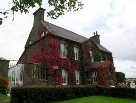 Keylong HouseHouse · 1.5 mi
 Knockgraffon CastleCastle · 1.7 mi
 Knockgraffon MotteArchaeological place · 1.8 mi
 Knockgraffon MoatCastle, motte and bailey · 1.9 mi
 Caher AbbeyHeritage attraction · 2.9 mi
 Siege of Cahir CastleSiege · 3.1 mi
 Cahir CastleCastle · 3.2 mi
 Pedunculate Oak4.0 mi
 European Yew4.2 mi
 CrossCross, High cross · 7.9 mi
 FarbreagaMountain / peak · 9.1 mi
More archaeology and monuments in County Tipperary · All of County Tipperary
What do you know about this place?