What is recorded here
Located on a slight rise at the outer edge of a shelf towards the top of the E-facing slope of a broad drumlin. The site of the medieval parish church of Oughteragh (LE025-008001-) is within a small circular graveyard (diam. c. 30m) which is depicted at the E end of a lane (L c. 70m) from a public road to the W on the 1835 edition of the OS 6-inch map. The old graveyard still has a masonry wall on its perimeter NW-E-SE, but is now part of a large rectangular graveyard (dims c. 75m NE-SW; c. 75m NW-SE) that has been extended further to the SE and NE. The head of a pointed window from the church is in the graveyard, but a stone head known as St. Bridget’s Head (LE025-008004-) is now at the Roman Catholic church in Ballinamore (LE025-118----). There was a holy well dedicated to St Bridget (LE025-008003-) in the vicinity of the graveyard but its precise location is not known. The holy well (LE025-009----) c. 550m to the NNE is still frequented and reached by the lane running E from the graveyard and a path through the fields northwards.
Compiled by: Michael Moore
Date of upload; 5 July, 2017
The monument record does not grant public access. Check the route and ask the landowner before entering private land.
- What survives
- Recorded monument
Places near here
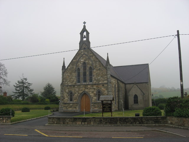 Church in OughteraghChurch · 7 yd
 St. Bridgets WellHoly well · 637 yd
 schoolschool · 1230 yd
 John Joe McGirlMonument · 1478 yd
 DrumbadMountain / peak · 1.0 mi
 DrumgownaghMountain / peak · 2.0 mi
 Cromlin Bridge WoodWood · 2.1 mi
 Turf IslandIsland · 2.9 mi
 Buck IslandIsland · 3.0 mi
 European ashEuropean ash · 3.1 mi
 Swan Island pet farmHeritage attraction · 4.0 mi
 CastleCastle, tower house · 4.1 mi