What is recorded here
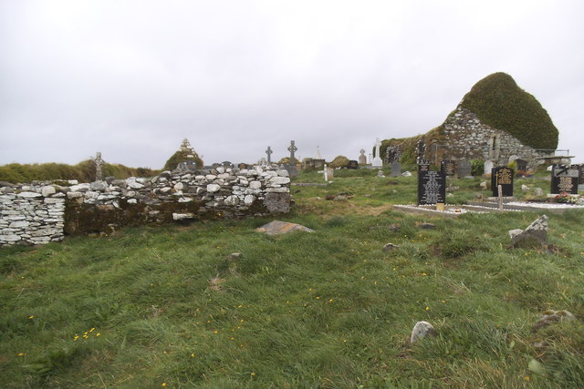
On top of a ridge overlooking coastline to E, roughly rectangular graveyard enclosed by stone-faced earthen bank. Many rows of low, uninscribed headstones; two chest tombs to E of church (CO151-024002-); earliest inscriptions date to 1760s. Pyramidal grave marker in SW quadrant; six gabled tombs to W of church. Still in occasional use.
From the National Monuments Service (Archaeological Survey of Ireland) record CO151-024001
The monument record does not grant public access. Check the route and ask the landowner before entering private land.
- What survives
- Recorded monument
Places near here
 Myross ChurchRuins · 17 ydCuaisín an GhainimhBay · 641 ydFaill a' TrahaneCliff · 965 ydRing Fort / LiosArchaeological place · 1050 ydHut site in Reen (carbery West (e.d) By.)Hut site · 1143 ydRón CarraigIslet · 1151 ydAn Gróibin ThuaidhWood · 1206 ydTráig MórBeach / strand · 1242 ydTrá na MuilleenBeach / strand · 1287 ydCnoc Sheáin de BarraMountain / peak · 1316 ydLow IslandIslet · 1475 yd
_-_geograph.org.uk_-_6532839.jpg/250px-Castles_of_Munster,_Raheen,_Cork_(2)_-_geograph.org.uk_-_6532839.jpg "Photo: Garry Dickinson, Wikimedia Commons · CC BY-SA 2.0") Raheen CastleCastle · 1.2 mi
Raheen CastleCastle · 1.2 miPictures: Mac McCarron, Geograph · CC BY-SA 2.0; Garry Dickinson, Wikimedia Commons · CC BY-SA 2.0
More archaeology and monuments in County Cork · All of County Cork
What do you know about this place?