
Places near here
Photo credits
- National Inventory of Architectural Heritage
- Jean-Pol GRANDMONT, Wikimedia Commons · CC BY 3.0
- Christian Pirkl, Wikimedia Commons · CC BY-SA 3.0 at
- Stephen Keaveny, Wikimedia Commons · CC BY-SA 4.0
- Nigel Thompson, Wikimedia Commons · CC BY-SA 2.0
- Mark Duncan, Geograph · CC BY-SA 2.0
- Garry Dickinson, Geograph · CC BY-SA 2.0
- XNukes, Wikimedia Commons · CC BY-SA 4.0
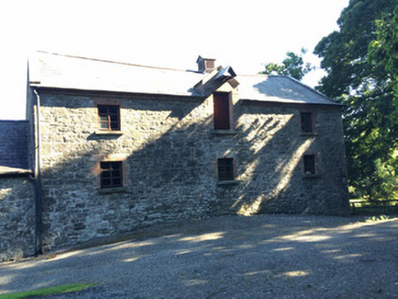 Martry MillMill (water) · 1188 yd
Explorer Tom Martry Mill bragged about surviving a storm that supposedly flattened half of County Meath, though I suspect it just got lucky. The waterwheel still spins for the tourists who don’t check the dates. If it rains, blame my imagination!
BallybegMountain / peak · 1.1 mi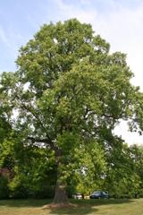 Tuliptree1.2 mi
Explorer Tom Tuliptree in County Meath made a New Year's resolution to stop looking so fancy. It failed spectacularly, of course, because it's just that pretty. Give it a pat on the way past, it's had a long life.
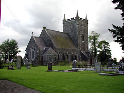 Saint Patrick's Church (Donaghpatrick)Church/chapel · 1.7 mi
Explorer Tom Saint Patrick's Church (Donaghpatrick) was designed by a mother-in-law who liked her windows with stained glass and her walls thick. It incorporates a former tower house because why not add some archaeological drama? Go in good boots and be ready for a lecture on limestone quality.
Faughan HillMountain / peak · 1.9 miCastle ruinsCastle · 2.6 mi Sycamore3.0 mi
 Round Tower3.9 mi
Explorer Tom The Round Tower in Town Parks nearly got sold for a horse back in the day. A king was murdered inside it, so the vibes are a bit intense. A proper spot for a flask of tea and a big think.
 Kells Round TowerVisitor attraction · 3.9 mi
 Kells High Crosses and Round TowerMemorial · 3.9 mi
 CastleCastle, motte · 4.4 mi
 Spire of LloydMonument · 5.0 mi
More archaeology and monuments in County Meath · All of County Meath

What do you know about this place?Tap to add a comment or ask a question