What is recorded here
Thirty-eighty metres south-east of Lea Castle, a square graveyard holds the last visible trace of a church that has mostly returned to soil. Its wall still marks the boundary, but inside the foundations have lost their shape and the western fragment offers no more than a hint of what stood there. The glebe name suggests clergy once lived and worked beside this place, tending the dead and the living in the same low-lying field.
Church (LA005-007-) in low lying area with little evidence of upstanding remains except for featureless fragment at W side of graveyard. Wall foundations E of centre of graveyard with no obvious pattern.
Square shaped graveyard (int. dims. 65m N-S; 58m E-W) enclosed by a stone wall as indicated on current ed OS 6-inch map. Church site in centre of graveyard. Located 380m to the SE of Lea Castle (LA005-006-).
Compiled by: Caimin O'Brien
Date of upload: 17 December 2007
The monument record does not grant public access. Check the route and ask the landowner before entering private land.
- What survives
- Recorded monument
Places near here
 Lea Church (in Ruins)Church · 7 yd
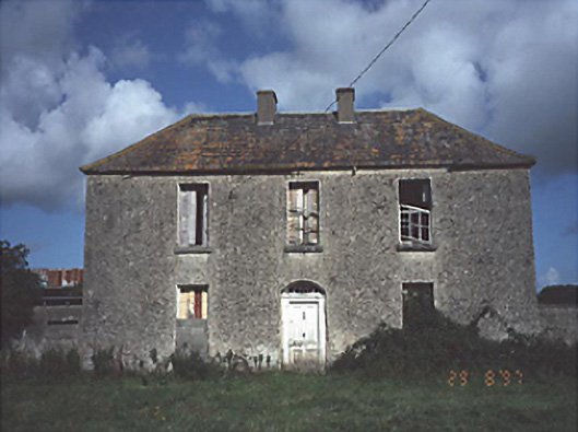 Lea Castle Househouse · 277 yd
 Lea Castle (in ruins)Castle, Anglo-Norman masonry castle · 459 yd
 CastleCastle, ringwork · 474 yd
 Church (in Ruins), GraveyardChurch · 1.4 mi
 RathmilesFairy fort / earthen ringfort · 1.8 mi
 Enclosure in Ballycarroll (portnahinch By.)Enclosure · 1.9 mi
 Bog Lake WalkWalking route · 2.3 mi
 Derryounce Walk (Yellow Loop)Walking route · 2.6 mi
 Wych ElmWych Elm · 2.7 mi
 Derryounce Lakes & TrailsNature reserve · 3.0 mi
 Emo CourtHeritage attraction · 4.0 mi