
What is recorded here
On NE side of Donoghmore crossroads; rectangular graveyard (c. 55m E-W; c. 40m N-S) enclosed by stone wall. In occasional use; many fine 18th- and 19th-century headstones, the earliest noted dated 1777, also some chest tombs (Coleman 1913-16; Buckley 1907-9). On N side many low uninscribed gravemarkers. Graveyard recently cleared of overgrowth by Community Council. At centre, ruins of C of I parish church of Donoghmore (CO050-102003-); interior occupied by mausoleum of Townsend and vault of Ruby families. Possible Man-made underground passage (CO050-102004-) near church. According to Smith (1750, vol. 1, 176) it was here that 'the parish priest kept a brazen hand, as an holy relic, by which the people swore upon all solemn occasions, but this hand was removed by one of the titular bishops of Cloyne'; this appears to be 12th century shrine of St Lachtain's arm, now in National Museum of Ireland (O Floinn 1994, 26, 45).
The above description is derived from the published 'Archaeological Inventory of County Cork. Volume 3: Mid Cork' (Dublin: Stationery Office, 1997). In certain instances the entries have been revised and updated in the light of recent research.
Date of upload/revision: 14 January 2009
The monument record does not grant public access. Check the route and ask the landowner before entering private land.
- What survives
- Recorded monument
Places near here
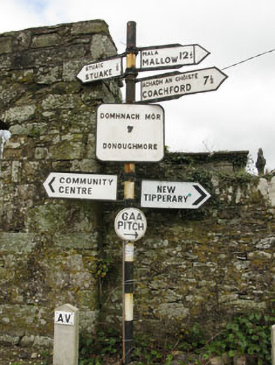 sign postsign post · 25 yd
 monumentmonument · 856 yd
 New TipperaryVisitor information · 1173 yd
 Lackabane LiosFairy fort / earthen ringfort · 1327 yd
 Fulachta FiadhFulacht fia · 1745 yd
 Saint Bartholomew's WellSpring · 1.7 mi
 Ballyvodane Castle (in Ruins)Castle, unclassified · 2.9 mi
 Oldcastle WoodWood · 3.2 mi
 Knockduff Wind FarmVisitor information · 3.3 mi
 Carrignamuck Tower HouseCastle · 4.3 mi
 Lyradane MountainMountain / peak · 4.9 mi
 Ballyanly Inniscarra Slí na SláinteWalking route · 5.3 mi
Other information
Photo: Credit not shown in the picture search · Rights wording not checked; contact us if this picture should be removed