
What is recorded here
Known locally as Drumrat graveyard after the parish in which it is located. A trapezoidal area (50m N-S; 40m E-W at N end; 55m E-W at S end) enclosed by a stone wall, with modern vertical stone-coping, on the E and S sides; the wall dates to 1831 (pers. comm. M. A. Timoney). The W and N boundaries were removed when…
Read the whole record
From the National Monuments Service (Archaeological Survey of Ireland) record SL039-074002
Places near here
Photo credits
- Maker not stated on source page, tr.pinterest.com
- Maker not stated on source page, www.pinterest.com
- Eastern Harps GAA Club; individual photographer not named, www.easternharps.com
- Jon Sullivan, Wikimedia Commons · CC0
- Oliver Dixon, Geograph · CC BY-SA 2.0
- National Inventory of Architectural Heritage
- Neville Goodman, Wikimedia Commons · CC BY-SA 2.0
- Eamonn McMunn / Sligo GAA (credit printed on photograph), www.sligogaa.ie
- Wikimedia Commons contributor · CC BY 2.5
- Sawyer777, Wikimedia Commons · CC BY-SA 4.0
- Gillaween, Wikimedia Commons · CC BY-SA 4.0
 Knockbrack CemeteryCemetery · 50 yd
Explorer Tom Knockbrack Cemetery would survive a zombie attack simply because the zombies would get confused by the layout. It’s…
 Fairy fort / earthen ringfort in BinganaghFairy fort / earthen ringfort · 691 yd
Explorer Tom Fairy fort / earthen ringfort in Binganagh is stuck in a massive dispute with the fairies over where their parking…
 Fr. Kevin Brehony Park, Eastern HarpsGAA ground · 799 ydFairy fort / earthen ringfort in BunnamuckFairy fort / earthen ringfort · 858 yd
Explorer Tom Fairy fort / earthen ringfort in Bunnamuck keeps its mouth shut about that secret, but I bet after three pints it’d…
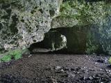 Caves of KeshCave · 1.2 mi
Explorer Tom Sixteen caves in one Sligo hillside? I would lose count halfway up and blame a ghost. The Caves of Kesh open across the…
 Kesh CorannMountain / peak · 1.6 mi
Explorer Tom Kesh Corann in County Sligo is basically the uncle at the wedding who won't stop talking about his harpist ancestor. It…
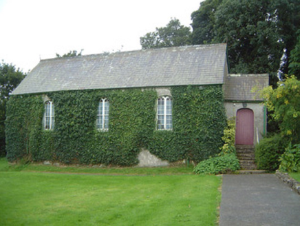 Graniamore Presbyterian ChurchChurch/chapel · 2.9 mi
Explorer Tom Graniamore Presbyterian Church has a family tree I invented entirely, involving at least three cousins named 'Solemn'.…
 New Kilmorgan Burial GroundCemetery · 4.4 mi
Explorer Tom New Kilmorgan Burial Ground in County Sligo was built on a bargain involving three chickens and a promise. I’m pretty…
 Brother Walfrid/Corran Park, Ballymote GAAGAA ground · 4.5 mi
 Curlew MountainsMountain / peak · 4.6 mi
Explorer Tom The Curlew Mountains may have nothing to do with curlew birds, which is awkward because I had prepared a terrific…
 Queen Medb: RathcroghanLegend location · 18 mi
Explorer Tom Queen Medb: Rathcroghan is where the Táin starts turning a quarrel about a bull into an epic. Medb had a royal seat…
 The Mórrígan: OweynagatLegend location · 18 mi
Explorer Tom The Mórrígan: Oweynagat is called the Cave of Cats, which fooled me into expecting a very ordinary sort of trouble.…
More archaeology and monuments in County Sligo · All of County Sligo

What do you know about this place?Tap to add a comment or ask a question