
What is recorded here
On the crest of a N-S ridge in undulating terrain. A rectangular graveyard (dims. 42m N-S; 37m E-W) enclosed by a stone wall. The entrance, with stones piers, is towards the S end of the W wall, the steps within the wall on the N side, both internally and externally. The N boundary of the graveyard runs up to the medieval church (TS070-101001-) which forms part of the northern boundary. Within the graveyard are two medieval graveslab (TS070-101008-; TS070-101009-) and an unlocated 17th-century graveyard (TS070-101010-).
From the National Monuments Service (Archaeological Survey of Ireland) record TS070-101002
Places near here
Photo credits
- Algirdas at Lithuanian Wikipedia, Wikimedia Commons · Public domain
- National Inventory of Architectural Heritage
- Mike Searle, Geograph · CC BY-SA 2.0
- Garry Dickinson, Geograph · CC BY-SA 2.0
- surrealpenguin, Wikimedia Commons · CC BY-SA 2.0
- A.-K. D., Wikimedia Commons · CC BY-SA 4.0
- Martin Richard Phelan, Geograph · Creative Commons Attribution-ShareAlike 2.0
- Colin Park, Geograph · CC BY-SA 2.0
- kevin higgins, Geograph · CC BY-SA 2.0
- P L Chadwick, Geograph · CC BY-SA 2.0
- Neil Theasby, Geograph · CC BY-SA 2.0
 Pedunculate Oak269 yd
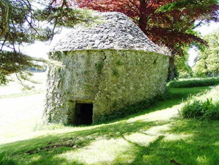 Kiltinan CastleDovecote/pigeon house/aviary · 271 yd
 Grove HouseGates/railings/walls · 661 yd
 Killusty CastleCastle · 1.2 mi
 Clare Castle (in ruins)Castle, hall-house · 1.9 mi
Explorer Tom Clare Castle in Clare Beg is secretly incredibly proud of one specific potato that grew near its base three hundred years ago. It’s a hall-house on an island, which sounds like a very exclusive, slightly damp club for historical architecture. Bring biscuits, every good story needs biscuits.
 Persian Walnut2.1 mi
 Sheela-na-gig in FethardSheela-na-gig · 2.2 mi
 Grave YardGraveyard · 2.3 mi
Explorer Tom Graveyard in Fethard had a fiddler who played there all night until the stones started dancing. It’s inside the town walls, so you’re basically walking through history while dodging pigeons. Bring wellies and low expectations, leave delighted.
 SlievenamonMountain / peak · 4.3 mi
 SheegounaMountain / peak · 4.6 mi
 Cashel Folk MuseumMuseum · 11 mi
 The Rock Of CashelVisitor information · 11 mi
More archaeology and monuments in County Tipperary · All of County Tipperary

What do you know about this place?Tap to add a comment or ask a question