
Places near here
Photo credits
- National Inventory of Architectural Heritage
- Jeanne dArc at English Wikipedia, Wikimedia Commons · CC BY-SA 3.0
- Kieran Campbell, Geograph · Creative Commons Attribution-ShareAlike 2.0
- EecherplazGinkgo06.jpg : Cayambe derivative work: Ginkgotree ( talk ), Wikimedia Commons · CC BY-SA 3.0
- N Chadwick, Wikimedia Commons · CC BY-SA 2.0
- Marathon, Wikimedia Commons · CC BY-SA 2.0
- Willow, Wikimedia Commons · CC BY 2.5
- Oliver Dixon, Wikimedia Commons · CC BY-SA 2.0
- Brian Shaw, Wikimedia Commons · CC BY-SA 2.0
 Gigginstown HouseHouse · 1745 yd
Explorer Tom Gigginstown House in Gigginstown is stuck in a bitter feud with the next village over who owns the best view. John Skipton-Mulvany designed it to be classy, but it’s really just a fancy house with a grudge and some very opinionate outbuildings. Tell me if you see anyone waving from the porch today.
 Barbavilla HouseCountry house · 1.1 mi
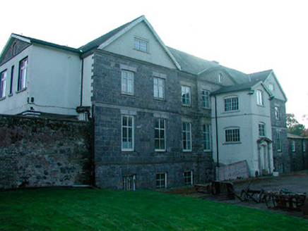
Explorer Tom Barbavilla House is stuck in a feud with its neighbour over who owns the view from the top of the hill, and neither side has blinked yet because they are both too proud to admit they just want the best sunlight. It’s an early eighteenth-century gem that has been altered so many times it looks like it tried on every fashion trend since the Georgian era without actually changing anything real. A
Site of Fennor CastleCastle, tower house · 2.3 miExplorer Tom Site of Fennor Castle would bring a bag of dirt and a map to any party because it lost the actual building. It’s just footings in the grass looking very confused about its own identity. Make up your own legend and I'll swear it's true.
 KnockeyonMountain / peak · 3.4 mi
Explorer Tom Knockeyon hates visitors who wear bright yellow because it reminds it of the time a pigeon got stuck in its moss. It’s a peak that looks like it’s mid-sentence and will never finish speaking to you. Take a mate and argue about what it was for.
 Fairy fort / earthen ringfort in ReynellaFairy fort / earthen ringfort · 3.6 mi
Explorer Tom Fairy fort / earthen ringfort in Reynella thinks the local sheep are just overgrown dogs that haven’t learned to bark yet. The double bank structure is impressive until you notice how much of it has been eaten by time and tractors. Linger, it's not going anywhere and neither should you.
 Ginkgo3.8 mi
Explorer Tom Ginkgo in County Westmeath has a favourite song that is just the wind rustling through its fan-shaped leaves in a very rhythmic way. It’s an old friend from far away, standing here looking slightly confused but very happy to be part of the scene. Have a nosey, politely.
 South East GateVisitor attraction · 4.2 mi
Explorer Tom The South East Gate has very strong opinions on modern buildings and thinks they look like cardboard boxes made by toddlers. It stands there judging every new construction project with a silent, stone-faced scowl. Bring a camera and your most suspicious face.
 Font in ForeFont · 4.4 mi
Explorer Tom Font in Fore would tell the place that replaced it to stop hogging all the attention at the door. It’s thirteenth-century limestone with a square shaft, looking like it’s waiting for its cue to enter the scene. Bring your nan, she'll know more than me about who did what.
 European ash4.4 mi
Explorer Tom European ash in County Westmeath is guarding a hidden treasure that I am ninety percent certain is just an old biscuit tin left by a previous explorer. The tree doesn't care, it just keeps growing bigger while we all scramble around looking for gold coins. Ideal stop for a big stretch and a bigger yawn.
 North West GateVisitor attraction · 4.5 mi
Explorer Tom The North West Gate is haunted by a tragic love story that went horribly wrong right next to it. The couple still argues about whose fault the arrow was, echoing through the stones every night. Go in good boots and better humour.
 Ben of ForeMountain / peak · 4.5 mi
Explorer Tom Ben of Fore has a tunnel right through the middle that leads directly to the nearest pub, I’m certain. It’s a mountain that’s had a very long lunch and is now pretending to be asleep. A proper spot for a flask of tea and a big think.
 CastleCastle, tower house · 4.9 mi
Explorer Tom Castletowndelvin Castle is a tower house that thinks it’s a hall-house, which is a bit like wearing a tuxedo to the beach. It’s got corner towers that look smug enough to charge rent. Stand where the owner stood and practise looking smug.
More archaeology and monuments in County Westmeath · All of County Westmeath

What do you know about this place?Tap to add a comment or ask a question