
What is recorded here
From the National Monuments Service (Archaeological Survey of Ireland) record TS083-012001
Places near here
Photo credits
- National Inventory of Architectural Heritage
- Maker not stated on source page, www.alamy.com
- Kenraiz, Wikimedia Commons · CC BY-SA 3.0
- Rabensteiner, Wikimedia Commons · CC BY 3.0
- Maker not stated on source page, en.wikipedia.org
- Maker not stated on source page, www.pinterest.com
- Irishtree, Wikimedia Commons · CC BY-SA 4.0
- Maker not stated on source page, www.dreamstime.com
- Maker not stated on source page, commons.wikimedia.org
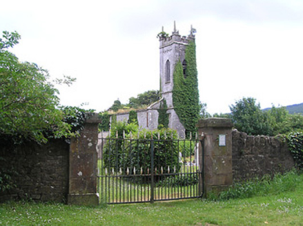 Killaloan ChurchChurch/chapel · 5 yd
Explorer Tom Killaloan Church is crumbling a bit, but its stone carvings are still showing off like it owns the place. There’s a…
 Church (in ruins)Church · 15 yd
Explorer Tom Church in Killaloan Lower has a long-standing grudge against the weather for always picking its side to blow up from.…
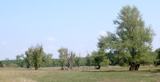 Black Poplar541 yd
Explorer Tom Black Poplar in County Tipperary is having a dramatic falling out with the nearest tree over who has the better view of…
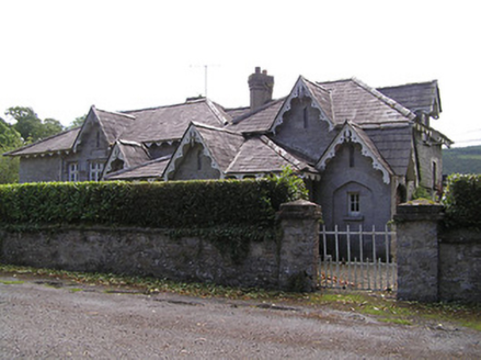 Newtownanner National SchoolSchool · 557 yd
Explorer Tom Newtownanner National School in Killaloan Lower, County Tipperary would be the best-dressed person at a wedding if…
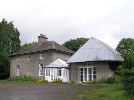 Kilheffernan HouseHouse · 1109 yd
Explorer Tom Kilheffernan House has a blank bay where a door should be, which confuses the local sheep because they think it is just…
 Norway Maple1112 yd
Explorer Tom Norway Maple in County Tipperary is claiming it is over five hundred years old, which I suspect is a complete lie…
 Earthwork in Newtownanner DemesneEarthwork · 1716 yd
Explorer Tom Earthwork in Newtownanner Demesne would tell the castle that replaced it, 'You're welcome for the foundation.' It’s…
 Enclosure in BallynevinEnclosure · 1.3 mi
Explorer Tom Enclosure in Ballynevin is where a poet once fell in a ditch and called it inspiration. Now it’s just a cropmark on…
 Gurteen CastleCastle · 1.4 mi
Explorer Tom Gurteen Castle in County Waterford is sick of being asked if it’s haunted, because it’s just a building with good…
 Powerstown CemeteryGraveyard · 1.7 mi
Explorer Tom Powerstown Cemetery in County Tipperary is hiding a tall tale about a tunnel that leads straight to the pub. Nobody has…
 Gammonsfield CemeteryGraveyard · 1.9 mi
Explorer Tom Gammonsfield Cemetery got into a massive row with the village two miles down the road over who had the ugliest…
 Ballyglasheen Castle (in ruins)House, fortified house · 1.9 mi
Explorer Tom Ballyglasheen Castle has a family tree that is mostly made up of cousins who never actually spoke to each other. It’s a…
More archaeology and monuments in County Tipperary · All of County Tipperary

What do you know about this place?Tap to add a comment or ask a question