What is recorded here
Situated on a slight rise in a low-lying, level landscape, with the original shore of Ballyteige Lough that was known as Mablen Haven in the 17th century (Simington 1953, 125, 149), c. 250m to the S. The parish church of Ballymagir or Killag (WX051-003001-) is within a subrectangular graveyard (dims c. 40m NE-SW; c. 25-30m NW-SE) defined by earthen banks, with a masonry wall at NE where a path (L c. 30m) leads to a NW-SE public road.
Compiled by: Micheal Moore
Date of upload: 17 February, 2014
A local ancient tomb; wider significance not recorded.
The monument record does not grant public access. Check the route and ask the landowner before entering private land.
- What survives
- Recorded monument
Places near here
 Church (in ruins), KillagChurch · 17 yd
 Fulacht fia in RichfieldFulacht fia · 1040 yd
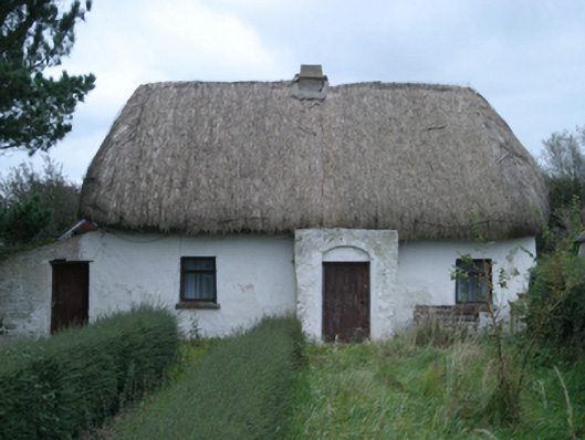 farm house, RICHFIELD (Reclaimed)farm house · 1061 yd
 bridge, BALLYTEIGE SLOBLANDbridge · 1182 yd
 Castle, unclassified in RichfieldCastle, unclassified · 1290 yd
 Cull IslandIsland · 1.8 mi
 Indicated, HooksCastle, motte · 1.8 mi
 Ivan Sutton Art ExhibitionGallery · 2.1 mi
 Memorial Trail & Garden in Honour of Those Lost at SeaMemorial · 2.1 mi
 Whale boneHeritage attraction · 2.1 mi
 Kilmore Quay - Crehen Twinning MemorialMemorial · 2.2 mi
 Kilmore Quay Walking TrailVisitor information · 2.2 mi