What is recorded here
Situated on top of a natural rise of ground in undulating countryside overlooking Pallas River 70m to W. Site of Pallas Castle (TN005-006001-) 190m to SW, Toberdima holy well (TN005-007001-) and St. Dima's Stone (TN005-007002-) 240m to E. The present remains consist of the ruins of Pallas [Dorrha] Church (TN005-005001-) which forms N boundary of graveyard with 19th century Dorrha C. of I. church in SW quadrant all of which stands inside an ecclesiastical enclosure (TN005-005002). Several late medieval architectural fragments including door and window surrounds belonging to the medieval church ruins have been inserted into the surface of the graveyard, possibly as grave-markers. The graveyard consists of an irregular shaped area enclosed by a post-1700 stone wall with entrance gate and stile at SW corner. The burial ground was originally enclosed in 1709 by Christopher Anistell of Sraduff House located 1.4km to the SE. A private walled burial area belonging to this family was built onto the E gable of the church. A large roughly rectangular-shaped burial area (dims. 25m N-S x 32m E-W) lies to the E of Dorrha C. of I. church and contains memorials dating from the post-1700 period onwards. A smaller burial area lies to the W of the medieval church ruins and numerous memorials and box tombs are visible inside the ruins of the medieval church.
Compiled and revised by: Caimin O'Brien
Date of revised upload: 12 October 2020
The monument record does not grant public access. Check the route and ask the landowner before entering private land.
- What survives
- Recorded monument
Places near here
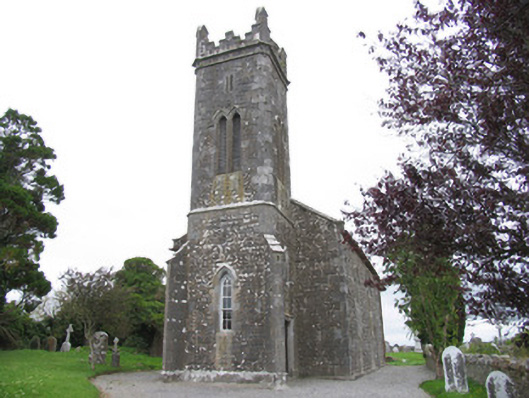 Dorrha Churchchurch/chapel · 23 yd
 Church (in ruins)Church · 41 yd
 Dotted OutlineEcclesiastical enclosure · 58 yd
 Toberdima (now dry)Holy well · 222 yd
 Site of Pallas CastleCastle, unclassified · 240 yd
 Site of Feddaun CastleCastle, unclassified · 2.7 mi
 Birr Castlemachinery · 3.5 mi
 European BeechEuropean Beech · 3.5 mi
 Pedunculate OakPedunculate Oak · 3.6 mi
 The Great Telescope 'Leviathan'Heritage attraction · 3.7 mi
 Waterfall PointViewpoint · 3.8 mi
 James Franklin FullerMemorial · 3.9 mi