What is recorded here
In grassland atop a natural rise of ground surrounded on three sides by Derryvella Bog, with good views in all directions. According to Gwynn and Hadcock (1988, 33) this was the site of the Early Christian monastery of Daire Mór which was associated with Bishop Colman, however, recent research has identified the…
Read the whole record
From the National Monuments Service (Archaeological Survey of Ireland) record TS048-035002
Places near here
Photo credits
- Maker not stated on source page, www.dreamstime.com
- Maker not stated on source page, www.pinterest.com
- Maker not stated on source page, www.adequatetravel.com
- Maker not stated on source page, www.youtube.com
- Maker not stated on source page, commons.wikimedia.org
- National Inventory of Architectural Heritage
- Maker not stated on source page, www.irelandhighlights.com
- Maker not stated on source page, carlowtourism.com
 Graveyard in Glengoole NorthGraveyard · 1027 yd
Explorer Tom Graveyard in Glengoole North is where smugglers hid their best whiskey before they got caught by a suspicious shepherd.…
 Site of ChurchChurch · 1027 yd
Explorer Tom Site of Church in Glengoole North would tell its younger self to stop worrying about the bog and start enjoying the…
 Glengoole Church CemeteryGraveyard · 1.3 mi
Explorer Tom Glengoole Church Cemetery was allegedly designed by a mother-in-law who wanted every single path to be exactly three…
 Stone circle in Glengoole SouthStone circle · 1.4 mi
Explorer Tom Stone circle in Glengoole South was levelled back in 1938 because someone decided they needed more room for their ego…
 Church (in ruins)Church · 1.6 mi
Explorer Tom Church in Lanespark in County Tipperary has an imaginary twin across the sea that is definitely doing better than it.…
 Lanespark GraveyardGraveyard · 1.6 mi
Explorer Tom Lanespark Graveyard makes a low humming sound at night that sounds suspiciously like someone trying to remember the…
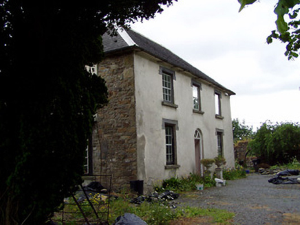 Hill View HouseHouse · 1.8 mi
Explorer Tom Hill View House has strict rules: no running on the bay window, no leaning on the decorative render. Its diminishing…
 Church in TullequaneChurch · 2.0 mi
Explorer Tom Church in Tullequane is unlocated, which means it could be anywhere, making it perfect for surviving a zombie attack by…
 Fairy fort / earthen ringfort in Lickfinn (lickfinn Par.)Fairy fort / earthen ringfort · 2.2 mi
Explorer Tom Lickfinn thinks the road leading here is an insult to its dignity. It sits in wet grass, judging your choice of…
Fairy fort / earthen ringfort in Lickfinn (crohane Par.)Fairy fort / earthen ringfort · 2.3 miExplorer Tom This Lickfinn ringfort hates tourists who wear bright yellow anoraks. The ditch is only visible from the west, which is…
 Ballymurreen castle (Site of)Bawn · 3.4 mi
Explorer Tom Ballymurreen Castle is having a bit of a melt-down. A Civil Survey chap said it was all 'out of repair' way back in…
 Ballymureen Castle (in ruins)Castle, unclassified · 3.4 mi
Explorer Tom Ballymureen Castle smells like old fireplaces and damp stone, according to Tom, because that’s just the vibe it gives…
More archaeology and monuments in County Tipperary · All of County Tipperary

What do you know about this place?Tap to add a comment or ask a question