
What is recorded here
From the National Monuments Service (Archaeological Survey of Ireland) record LI057-049002
Places near here
Picture notes
- National Inventory of Architectural Heritage
- Computer-made picture. It does not show this monument.
- Computer-made picture. It does not show this holy well.
- john salter, Geograph · CC BY-SA 2.0
- Computer-made picture. It does not show this mountain top.
- Computer-made picture. It does not show this playground.
- CaitNi, Wikimedia Commons · CC BY-SA 4.0
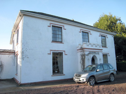 Darragh HouseHouse · 131 yd
 Settlement cluster in Darragh MoreSettlement cluster · 466 ydComputer-made picture
Explorer Tom Settlement cluster in Darragh More would survive a zombie attack by hiding in the one spot nobody can find. It was called an ancient city, so it takes itself very seriously. Go in good boots and better humour.
 TobermacduaghHoly well · 548 ydComputer-made picture
Explorer Tom Tobermacduagh in Darragh More is secretly proud of its potato-sized spring, surrounded by beech trees that judge your fashion choices. It cures ailments but mostly just cures boredom. Leave nothing but footprints and a bad pun.
 Darragh BridgeBridge · 672 yd
Explorer Tom Darragh Bridge thinks the road leading up to it is a complete amateur. It stands there looking fancy and all dressed up in sandstone. Bring your nan, she’ll love the drama of that 1798 battle spot.
 CarrighenryMountain / peak · 1165 ydComputer-made pictureSite of CastleCastle, unclassified · 1.2 mi
 Children's playground1.5 miComputer-made pictureKilclooney WoodWood · 1.5 mi
 CarrigeenamronetyMountain / peak · 1.7 miCastleCastle, unclassified · 3.4 mi
Explorer Tom Marshalstown Castle is said to be under the farm buildings behind the now-demolished house. A 1588 grant mentions it, but there's no evidence left in the walls. It's like a secret kept by the Condons and White Knights borderland.
Ballyhoura WayWalking route · 3.8 miPalatine's RockNamed rock · 4.1 miMore archaeology and monuments in County Limerick · All of County Limerick

What do you know about this place?Tap to add a comment or ask a question