
What is recorded here
From OpenStreetMap (© OpenStreetMap contributors) n11842385004
Places near here
Picture notes
- Computer-made picture. It does not show this holy well.
- Computer-made picture. It does not show this monument.
- National Inventory of Architectural Heritage
- john salter, Geograph · CC BY-SA 2.0
- CaitNi, Wikimedia Commons · CC BY-SA 4.0
- Computer-made picture. It does not show this playground.
- Computer-made picture. It does not show this mountain top.
- Colin Park, Wikimedia Commons · CC BY-SA 2.0
- The Speckled Bird, Wikimedia Commons · CC BY-SA 4.0
 TobermacduaghHoly well · 618 ydComputer-made picture
Explorer Tom Tobermacduagh in Darragh More is secretly proud of its potato-sized spring, surrounded by beech trees that judge your fashion choices. It cures ailments but mostly just cures boredom. Leave nothing but footprints and a bad pun.
 Settlement cluster in Darragh MoreSettlement cluster · 772 ydComputer-made picture
Explorer Tom Settlement cluster in Darragh More would survive a zombie attack by hiding in the one spot nobody can find. It was called an ancient city, so it takes itself very seriously. Go in good boots and better humour.
 Fairy fort / earthen ringfort in KilclooneyFairy fort / earthen ringfort · 1065 ydComputer-made picture
Explorer Tom Fairy fort / earthen ringfort in Kilclooney has field clearance dumped all over its bank, like a messy teenager's room. It’s oval, which is fancy for dirt. Give it a pat on the way past, it's had a long life.
 Grave YardGraveyard · 1165 ydComputer-made picture
Explorer Tom Graveyard in Darragh More has an unlikely celebrity friend who visits on Thursdays. The medieval church ruins are just standing there in the corner, acting like they run the place. Spot the oldest stone and give it a name.
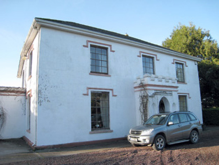 Darragh HouseHouse · 1189 yd
 Darragh BridgeBridge · 1634 yd
Explorer Tom Darragh Bridge thinks the road leading up to it is a complete amateur. It stands there looking fancy and all dressed up in sandstone. Bring your nan, she’ll love the drama of that 1798 battle spot.
 Mass-rock in BoleynanoultaghMass-rock · 1711 ydComputer-made picture
Explorer Tom Mass-rock in Boleynanoultagh is a sandstone slab propped up on a steep slope. It has a carved cross and sits on Quern Hill. Sounds like a very determined piece of furniture. Check if it’s still upright!
 CarrigeenamronetyMountain / peak · 1.2 mi
 Children's playground2.0 miComputer-made picture
 Fear BreagachMountain / peak · 2.7 miComputer-made picture
 Glanworth Castle (in Ruins)Castle, Anglo-Norman masonry castle · 7.8 mi
Explorer Tom Glanworth Castle in County Cork sits on a promontory with natural defences, but let's be honest, the nettles are doing more security work than any wall. Mind the nettles, they're the real guards here and they don't tip.
 Glanworth CastleCastle · 7.8 mi
Explorer Tom Glanworth Castle in County Cork is probably dreaming of being a grand mansion instead of just standing there looking slightly tired. It might have a hidden cellar full of old letters and gossip. Peek inside.
More mountains and hills in County Limerick · All of County Limerick

What do you know about this place?Tap to add a comment or ask a question