
Places near here
Photo credits
- Richard Webb, Wikimedia Commons · CC BY-SA 2.0
- Kenneth Allen, Geograph · Creative Commons Attribution-ShareAlike 2.0
- National Inventory of Architectural Heritage
- Kenneth Allen, Wikimedia Commons · CC BY-SA 2.0
- John M, Geograph · Creative Commons Attribution-ShareAlike 2.0
- Kmcnamee, Wikimedia Commons · CC BY-SA 4.0
- Kenneth Allen, Geograph · CC BY-SA 2.0
Explorer Tom Enclosure in Larkfield claims to be older than the hills themselves. It’s just a grassy circle on a drumlin, but I’m…
Giants RockNamed rock · 1.4 miExplorer Tom Giants Rock in Leitrim would bring a very heavy conversation to any party it was invited to. It’s just a named rock…
 BenboMountain / peak · 1.5 mi
Explorer Tom Benbo was saved by a hero named Seamus who nobody remembers because he died of indigestion before the credits rolled on…
The Giants GraveArchaeological place · 1.7 miExplorer Tom The Giants Grave in County Leitrim needs an epitaph that says he died of indigestion after eating too many leprechauns.…
 Kilcoosey National SchoolSchool · 2.0 mi
Explorer Tom Kilcoosey National School has a family tree that is mostly made up of teachers who forgot their own names by 1915.…
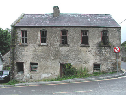 mill (water)2.3 mi
Explorer Tom Mill in Manorhamilton is derelict, and the wind keeps picking on it because it’s jealous of modern turbines. It stands…
 Manorhamilton CastleCastle · 2.4 mi
Explorer Tom Manorhamilton Castle hosted a dance in 1652 that went so far that the whole building caught fire while everyone was…
 IndicatedBastioned fort · 2.5 mi
Explorer Tom Manorhamilton’s bastioned fort claims its unlikely celebrity friend is a very serious statue of a general who never…
 Bee Park, Glencar Manorhamilton GAAGAA ground · 2.5 miGreen IslandIslet · 3.0 mi
Explorer Tom Green Island in County Leitrim smells like old tea leaves and forgotten secrets, according to my very scientific nose…
St. Osnat's GAA, GlencarGAA ground · 3.2 mi Dough MountainMountain / peak · 5.9 mi
Explorer Tom Dough Mountain is listening to every whisper from its neighbours, which explains why it looks so perpetually smug about…
More archaeology and monuments in County Leitrim · All of County Leitrim

What do you know about this place?Tap to add a comment or ask a question