What is recorded here
On gentle N-facing slope with good views from SSE-S-SW. Clomantagh Castle (KK013-002001-) and bawn (KK013-002002-) are located c. 130m to the N. There are earthworks (KK013-002005-) in the field immediately N of the graveyard (KK013-003002-). A 13th-century church (KK013-003001-) is located close to S boundary wall of the graveyard. According to the OS Letters (1839), there is, ‘a large and much frequented burying ground attached to it’ (O’Flanagan ed. 1930, vol. 1, 161-2 (52-3)). On the 1st (1839) ed. OS 6-inch map the grave yard is indicated by a dashed line which suggests that the boundary was not fixed. By the revised 1900 ed. the graveyard is indicated by a continuous line which suggests the boundary wall had been built between 1839 and 1900. A roughly rectangular graveyard (dims. c. 71m E-W; c. 32m N-S at E end tapering to c. 16m at the W end) with a public road running E-W outside the S boundary. It is entered at the E end of the S wall. The visible headstones date from the late 18th century onwards. Following a clean-up of the graveyard in the 1990s a large number of cut stones (KK013-003003-) were uncovered. Some were kept within the graveyard while others were placed in the adjoining field.
See attached photographs:
KK013-003002-_01 View from NW within graveyard, with W gable of church (KK013-003001-)
KK013-003002-_02 View from NW along N portion of graveyard
KK013-003002-_03 SW portion of graveyard
KK013-003002-_04 Graveyard N of the church (KK013-003001-), from NW
Compiled by: Jean Farrelly
Date of upload: 23 July 2019
The monument record does not grant public access. Check the route and ask the landowner before entering private land.
- What survives
- Recorded monument
Places near here
 Clomantagh Church (in ruins)Church · 13 yd
 Sheela-na-gig in Clomantagh LowerSheela-na-gig · 138 yd
 CastleCastle, tower house · 142 yd
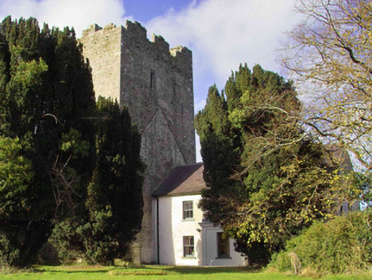 farm housefarm house · 181 yd
 Fairy fort / earthen ringfort in Clomantagh LowerFairy fort / earthen ringfort · 400 yd
 Tubbrid Castle (in ruins)Castle, tower house · 1589 yd
 Clomantagh HillMountain / peak · 1.5 mi
 Kildrinagh WoodForest · 2.2 mi
 John HelyMemorial · 3.3 mi
 DelaneyMemorial · 3.4 mi
 Street fieldArchaeological place · 4.5 mi
 Anker's IslandIsland · 8.1 mi