Places near here
Photo credits
- MonikaLisa2, Wikimedia Commons · CC BY-SA 4.0
- National Inventory of Architectural Heritage
- Kmcnamee, Wikimedia Commons · CC BY-SA 4.0
- E. H. (E. Hayden), Wikimedia Commons · Public domain
- Mike Searle, Geograph · CC BY-SA 2.0
- dougf, Geograph · CC BY-SA 2.0
- Gfwc70, Wikimedia Commons · CC BY-SA 4.0
- Willow, Wikimedia Commons · CC BY 2.5
- john berry, Geograph · CC BY-SA 2.0
- Sitomon, Wikimedia Commons · CC BY-SA 2.0
- The Speckled Bird, Wikimedia Commons · CC BY-SA 4.0
 Clashmore Heritage CentreChurch/chapel · 52 yd
Explorer Tom Clashmore Heritage Centre used to be a church, now it’s a heritage spot that definitely hides a biscuit tin in the…
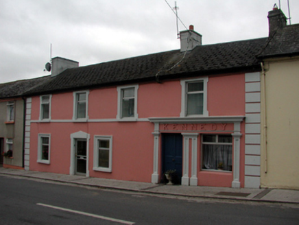 KennedyHouse · 91 yd
Explorer Tom Kennedy in Clashmore thinks Saint Patrick would have loved it because it has plenty of green space on its sloping site…
 Clashmore / Kinsalebeg GAA pitchGAA ground · 489 yd
 Strancally Castle (in ruins)Castle, hall-house · 1.8 mi
Explorer Tom Strancally Castle has strict rules for visitors: no touching the rock, no asking about the rebellion, and definitely no…
 Molana AbbeyHeritage attraction · 2.9 mi
Explorer Tom Molana Abbey in County Waterford is having a total meltdown on reality TV right now. It’s been standing there since the…
 Templemichael CastleCastle · 3.0 mi
Explorer Tom Templemichael Castle in County Waterford has a name that sounds like someone said 'temple' and 'Michael' at the same…
 Site of ChurchChurch · 3.0 mi
Explorer Tom Site of Church in Templemichael is stuck in a feud with the clouds. The church rotted away centuries ago, but the sky…
 European ash3.2 mi
Explorer Tom European ash in County Waterford somehow ended up in the wrong place, probably because it got confused on its way to a…
 Ferry PointViewpoint · 3.9 mi
Explorer Tom Ferry Point has very strong opinions about modern buildings, thinking they’re all just tall concrete blocks lacking in…
 European Yew4.0 mi
Explorer Tom European Yew in County Cork is basically a green shrug against time itself. It’s ancient, brooding, and probably…
 Collegiate Church of Saint MaryHeritage attraction · 4.0 mi
Explorer Tom St Mary's Collegiate Church sits above Youghal with an oak roof old enough to make the rest of my itinerary look like a…
Magners Hill, YoughalGAA ground · 4.3 miMore archaeology and monuments in County Waterford · All of County Waterford

What do you know about this place?Tap to add a comment or ask a question