What is recorded here
On gentle W-facing slope, overlooking Long Strand to S, within Castlefreke demesne. Roughly rectangular yard enclosed by stone wall; contains ruins of Rathbarry parish church (CO143-076002-) and to N ruins of C of I parish church (CO143-076002-). This latter church built in 1825 (Lewis Vol. 2 1837, 488-9); it is now roofless though walls stand to full height; rectangular in plan (long axis NE-SW) with shallow chancel projection to NE, pinnacled tower at W corned and entrance porch at S corner; it was closed in 1927.
On gentle W-facing slope, overlooking Long Strand to S, within Castlefreke demesne. Roughly rectangular yard enclosed by stone wall; contains ruins of Rathbarry parish church (CO143-076002-) and to N ruins of C of I parish church (CO143-076002-). This latter church built in 1825 (Lewis Vol. 2 1837, 488-9); it is now roofless though walls stand to full height; rectangular in plan (long axis NE-SW) with shallow…
From the National Monuments Service (Archaeological Survey of Ireland) record CO143-076001
The monument record does not grant public access. Check the route and ask the landowner before entering private land.
- What survives
- Recorded monument
Places near here
Photo credits
- Garry Dickinson, Geograph · Creative Commons Attribution-ShareAlike 2.0
- Garry Dickinson, Geograph · CC BY-SA 2.0
- Mike Searle, Geograph · CC BY-SA 2.0
- Draceane, Wikimedia Commons · CC BY-SA 4.0
- Caitlin Ferguson-Mir, Wikimedia Commons · CC BY-SA 2.0
- Owen O'Sullivan, Geograph · CC BY-SA 2.0
- Hywel Williams, Geograph · CC BY-SA 2.0
- Andreas F. Borchert, Wikimedia Commons · CC BY-SA 4.0
- Hywel Williams, Wikimedia Commons · CC BY-SA 2.0
- Mike Searle, Wikimedia Commons · CC BY-SA 2.0
- Warren Buckley, Geograph · CC BY-SA 2.0
 Rathbarry ChurchChurch/chapel · 13 yd
 Rathbarry Church RuinRuins · 36 yd
 Castle Freke WoodsForest · 385 yd
 Chilean myrtle685 yd
 Ownahincha Strand (West)Beach / strand · 1.2 mi
 Downeen Castle (in Ruins)Castle, tower house · 2.3 mi
 Galley HeadViewpoint · 2.3 mi
 St Fachtnas CathedralCathedral · 2.6 mi
 Michael Collins MemorialMemorial · 3.2 mi
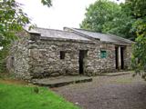 Michael Collins BirthplaceHistoric birthplace · 3.5 mi
 Coppingers CourtCastle · 4.0 mi
 Inchydoney BeachBeach / strand · 4.9 mi
More archaeology and monuments in County Cork · All of County Cork
What do you know about this place?