
Places near here
Photo credits
- National Inventory of Architectural Heritage
- Kmcnamee, Wikimedia Commons · CC BY-SA 4.0
- Vanessa Kennedy, Wikimedia Commons · CC BY 2.0
- DeeEmm, Geograph · CC BY-SA 2.0
- Golfing in Ireland; photographer not stated, Source publisher
- Mike Searle, Geograph · CC BY-SA 2.0
- Dirk Huth, Wikimedia Commons · CC BY-SA 3.0
- Mike Searle, Wikimedia Commons · CC BY-SA 2.0
Explorer Tom St. Bridgets Well in Loughrea was designed by the most critical mother-in-law in history. It has a pear-shaped chamber…
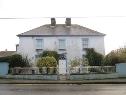 Saint Bride'sHouse · 234 yd
Explorer Tom Saint Bride's in Loughrea would probably rate its own visitors a six out of ten if it had a voice and a clipboard. It’s…
 Rock HouseHouse · 268 yd
Explorer Tom Rock House in Loughrea might be hiding contraband from a ridiculous smuggling story I made up. It’s got railings that…
 Loughrea GAAGAA ground · 639 yd
 St. Brendans Catholic CathedralCathedral · 682 yd
Explorer Tom St. Brendans Catholic Cathedral in Loughrea is the big one, and locals swear by touching the third pillar from the left…
Bush IslandIslet · 968 ydExplorer Tom Bush Island bragged about surviving a storm that split its top in half, but no one believes it because it’s just a…
Middle IslandIslet · 1002 ydExplorer Tom Middle Island is where some guy allegedly smuggled a whole wedding cake in 1790, hiding it under his armpit while…
 Long PointHeadland · 1.1 mi
Explorer Tom Long Point in County Galway is absolutely shredding those Dublin tourists who think they know the coast. It’s standing…
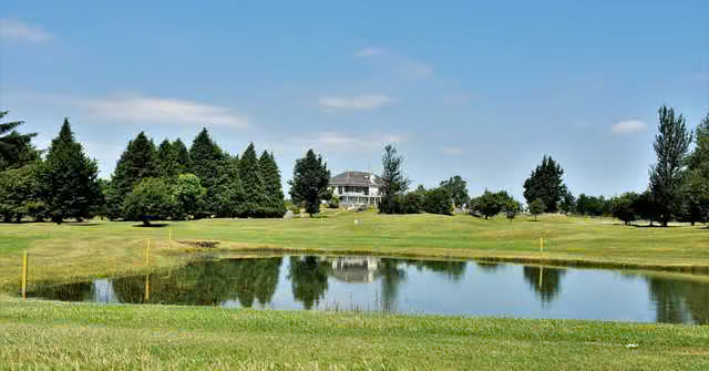 Loughrea Golf ClubGolf course · 1.2 mi
 Raruddy Castle (in ruins)Castle, tower house · 1.6 mi
Explorer Tom Raruddy Castle in Galway is a mystery wrapped in a bush. I bet after three pints, it’d spill every dark secret of the…
 Turoe StoneHeritage attraction · 3.6 mi
Explorer Tom Turoe Stone in County Galway hosted a dance party three thousand years ago where everyone went too far and forgot how…
 Castle (in ruins)Castle, tower house · 4.7 mi
Explorer Tom Castle at Dunsandle is playing hard to get. If it hit the lotto, I bet it’d just buy a really big hat and nap in the…
More archaeology and monuments in County Galway · All of County Galway

What do you know about this place?Tap to add a comment or ask a question