What is recorded here
Kilbixy Church (WM011-040002-) dedicated to St. Bigseach standing in centre of small graveyard. Motte and bailey castle (WM011-039----) located 200m NNW of church and graveyard (WM040005-), leper hospital (WM011-040001-) immediately to S of graveyard and deserted medieval settlement earthworks (WM011-155----) in field to W and N. Bridget's Well (WM011-038----) located 250m to SW. According to the Urban Survey of Ireland (Bradley et. al. 1985, 108-09) ‘the church of Kilbixy granted by Geoffrey de Costentin to Ralph Petit, archdeacon of Meath, in a charter of 1192/1218 is to be identified with this church, established before the coming of the Normans (Clarke 1941, 90). Shortly after the foundation of priory at Tristernagh it was granted to the Augustinian canons there (Clarke 1941, 91). The parish church of Kilbixy is specifically mentioned in 1259 (Clarke 1941, 122), 1492 (Cal. papal letters 1978, 430) and 1540 (White 1943, 277). In 1682 Piers (1981, 77) described it as ‘the remains of an ancient and well built church, the mother of many churches and chapels about it, which had at the west end a very well built high tower or steeple’. The present church, which is in ruins, was constructed in the late 1700s. No medieval fabric survives above ground. The semi-circular enclosing ditch north-east of the church represents the remains of a post-medieval fosse dug as a landscape feature such as a ha-ha associated with the 18th century C of I church building. The construction of this feature was described in the 1793 edition of Anthologia Hibernica (Anon. 1793, 316). In 1980 an Early Christian sandstone cross-slab (WM011-040007-) was discovered in the graveyard during a clean up scheme and is now on display inside the C of I church. This enclosing ditch is visible on Bing Maps aerial photograph taken November 2011. Octagonal limestone font (WM011-040004-) north-east of the church. Chamfered limestone fragment (dims. H 0.46m; Wth. 0.27m; T 0.26m) of an arch of medieval date used as a grave-marker’. The present C of I church ruins were probably built on the site of the medieval parish church.
Compiled by: Caimin O'Brien
Date of upload: 27 May 2014
Medieval Christian burial ground, associated with a church, motte and bailey castle, and leper hospital. Its significance lies in its connection to a complex of religious and defensive structures, indicating a settlement of some importance during the medieval period.
The monument record does not grant public access. Check the route and ask the landowner before entering private land.
- What survives
- Recorded monument
Places near here
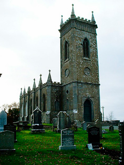 Saint Bigseach's Church (Kilbixy)church/chapel · 11 yd
 Font in Baronstown DemesneFont · 12 yd
 Horse-chestnutHorse-chestnut · 44 yd
 Man-made underground passage in Baronstown DemesneMan-made underground passage · 93 yd
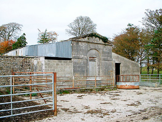 Baronstown HouseOfficially recorded historic building · 187 yd
 CastleCastle, motte and bailey · 256 yd
 Baronstown ForestWood · 307 yd
 Site of Castle, Castle FieldCastle, unclassified · 890 yd
 Newcastle WoodsForest · 8.9 mi
 Rock of CurryCliff · 12 mi
 Settlement desertedSettlement deserted, medieval · 217 yd
 Bridgets WellHoly well · 291 yd