
What is recorded here
D-shaped graveyard (int. dims. 24m N-S; 35m E-W) with S and E wall built on bank of bivallate ringfort (OF034-004003-). Described by Carrigan as 'The church (LA034-004001-) of Ballybuggy was situated on the summit of a low hill, within a round rath (LA034-004003-) 40 yards in diameter and still showing traces of a…
Read the whole record
From the National Monuments Service (Archaeological Survey of Ireland) record LA034-004002
Places near here
Photo credits
- National Inventory of Architectural Heritage
- Mike Searle, Geograph · CC BY-SA 2.0
- A.-K. D., Wikimedia Commons · CC BY-SA 4.0
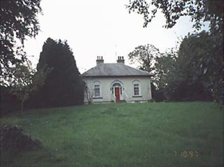 Erkin ViewHouse · 1.2 mi
Explorer Tom Erkin View in Rathdowney has a local legend about a giant who hid his boots under the cobbles. It’s a house over a basement with a detached coach house. Look serious, nod slowly, you're basically an expert now.
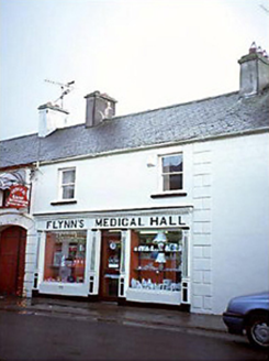 Flynn's Medical HallOfficially recorded historic building · 1.3 mi
Explorer Tom Flynn's Medical Hall in Rathdowney thinks it’s cooler than the other shops on Main Street. It got a shopfront in 1930 and never stopped showing off. If it's closed, admire it from the road like a polite stalker.
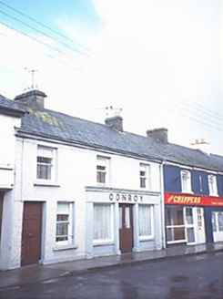 ConroyOfficially recorded historic building · 1.3 mi
Explorer Tom Conroy House has made a New Year's resolution to stop its render pilasters from looking like they’re trying to sell shoes. It’s been doing this act since 1890 without even getting tired of the performance! Find a local and ask them the real story, then come back and tell me.
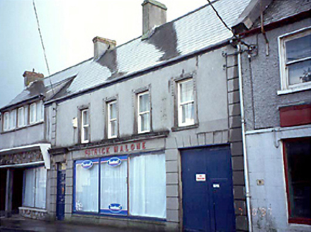 Patrick MaloneOfficially recorded historic building · 1.3 mi
Explorer Tom Patrick Malone has had more former names than I’ve had jobs in my life. The ground floor is disused now, so it’s just listening to the street gossip all day. Stand on the spot and imagine the gossip it's heard.
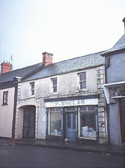 P. WhelanOfficially recorded historic building · 1.3 mi
Explorer Tom P. Whelan started after two lads bet on who could stand under the shopfront longest. It’s been a retail outlet since 1910 and never once blinked. Give it a pat on the way past, it's had a long life.
 Ballagh CastleCastle · 2.6 miBallagh Castle (in Ruins)Bawn · 2.6 miCnoc SeanrathaMemorial · 2.9 miClonmeen WoodWood · 3.8 mi
Explorer Tom Clonmeen Wood has decided its New Year's resolution is to stop falling leaves so aggressively in October and be more subtle about it. It’s trying to be chic, but it’s failing miserably. A proper spot for a flask of tea and a big think.
 Grave YardGraveyard · 4.2 mi
 Burial GroundGraveyard · 4.3 miBig WoodWood · 4.7 mi
More archaeology and monuments in County Laois · All of County Laois

What do you know about this place?Tap to add a comment or ask a question