Places near here
Photo credits
- National Inventory of Architectural Heritage
- A.-K. D., Wikimedia Commons · CC BY-SA 4.0
- Garry Dickinson, Wikimedia Commons · CC BY-SA 2.0
- Algirdas at Lithuanian Wikipedia, Wikimedia Commons · Public domain
- kevin higgins, Wikimedia Commons · CC BY-SA 2.0
- Mike Searle, Wikimedia Commons · CC BY-SA 2.0
- Andreas F. Borchert, Wikimedia Commons · CC BY-SA 4.0
- Christian Pirkl, Wikimedia Commons · CC BY-SA 3.0 at
- Mooro1, Wikimedia Commons · CC BY-SA 4.0
- Graham Horn, Geograph · CC BY-SA 2.0
 Station HouseRailway station · 578 yd
Explorer Tom The other Station House in Townparks is an L-shaped former railway building that definitely saw a fox take charge during a particularly chaotic night shift. The goods shed out back is just sitting there, disused and judging everyone who walks past it. Count the crows, then count again.
 United Irishmen MonumentMonument · 643 yd
Explorer Tom United Irishmen Monument in Townparks is a Celtic Cross that might have been chased by a fox once. The railings are there to keep the history in, or the dogs out. Stand where the owner stood and practise looking smug.
 St. Bridgets WellHoly well · 3.1 mi
Explorer Tom St. Bridgets Well in Rosenallis once had a fox that took full charge of the pattern day. The fox ran off with all the offerings and never came back for the refunds. Mind the nettles, they're the real guards here.
 Tinnakill Castle (in Ruins)Castle, tower house · 3.5 mi
Explorer Tom Tinnakill Castle was designed by a mother-in-law who thought four storeys wasn't enough to keep everyone separate. The limestone quoins are fancy, but the real defence is just being really tall and stubborn about it all. Bring a friend who talks too much and let the place shut them up.
 Pedunculate Oak4.2 mi
Explorer Tom Pedunculate Oak in County Offaly is where a priest once lost a bet about how many acorns he could catch before dinner. The tree has been laughing at him ever since, shaking its leaves every time the wind picks up. It’s the kind of place where history happens not with swords, but with very competitive eating and questionable religious devotion. A handy
 BaunreaghcongMountain / peak · 7.9 mi
Explorer Tom Baunreaghcong in County Laois has a summit pond that looks like it’s trying to drown in its own reflection. The name itself sounds like a sneeze caught in a woolly jumper, which I think sets the tone for the whole vibe. Find the wonkiest bit and send it to your group chat.
 Lea Castle (in ruins)Castle, Anglo-Norman masonry castle · 8.1 mi
Explorer Tom Lea Castle has circular angle towers that look like they’re winking at you. A fox took charge last Tuesday and seemed to enjoy the view. Tell it a joke, it's been a long time since anyone did.
 Ritual siteRitual site, holy tree/bush · 8.5 mi
Explorer Tom Clonenagh's holy ash tree contains water with healing powers, according to the local sheep who just eat it anyway. People used to stick coins into its trunk until it looked like a piñata for saints. Pretend you're a lost aristocrat, nobody will check your ID.
 Sycamore8.5 mi
Explorer Tom This Sycamore is lying about its age and says it was actually a dragon that turned into wood. I believe it, because who else would grow that big? Have a look and decide if I was lying.
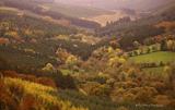 Slieve Bloom MountainsMountain range · 9.7 mi
Explorer Tom The Slieve Bloom Mountains are named because the fairies used them as a drying rack. Locals say the peaks actually glow blue when the wind blows right. Sit on a wall near it and pretend you're in a painting.
 CemeteryGraveyard · 12 mi
Explorer Tom Cemetery in Carricksallagh would post on social media: 'Just another day overlooking Stradbally, feeling very important about my square stone wall expansion project.' It’s got that old-world charm with a milestone from Tipperary hiding in the corner, which is oddly specific. Perfect place to be dramatically windswept.
 Oughaval Wood MapVisitor information · 12 mi
Explorer Tom Oughaval Wood Map is cursed so that anyone who doesn't wave at the trees will get lost in a loop for three days straight. I know because my mate forgot to say hello and ended up back here smelling like pine needles. Find the wonkiest bit and send it to your group chat.
More memorials and graveyards in County Laois · All of County Laois

What do you know about this place?Tap to add a comment or ask a question