Places near here
Photo credits
- Michael Murtagh, Geograph · CC BY-SA 2.0
- Paul O'Brien, Geograph · CC BY-SA 2.0
- Michael Murtagh, Wikimedia Commons · CC BY-SA 2.0
- Kenneth Allen, Geograph · CC BY-SA 2.0
- Otter, Wikimedia Commons · CC BY-SA 4.0
- Michael Spence, Wikimedia Commons · CC BY-SA 4.0
- Kenneth Allen, Wikimedia Commons · CC BY-SA 2.0
 Corick MountainMountain / peak · 1401 yd
Explorer Tom Corick Mountain in County Derry acts like it’s got a secret life when nobody is looking at it, probably rearranging its own rocks for fun. It’s a bit shy about being the second peak but still manages to steal all the attention from its more famous sibling. Best enjoyed with a bag of chips and no plans.
 White MountainMountain / peak · 1.6 mi
Explorer Tom White Mountain in County Derry keeps its secrets so tight that even the lichen growing on it has sworn to stay quiet after a few pints. It tells tales of lost ships and buried treasure that are probably just old tin cans and rusted nails from the last war. Tell it a joke, it's been a long time since anyone did.
 Craig-na-ShokeCliff · 1.8 mi
Explorer Tom Craig-na-Shoke in County Derry is a cliff known as Eagle's Rock, probably because an eagle once got its hat stuck there and refused to leave. I reckon it took forty cups of tea to build this view for us. Dare you to say hello to it out loud.
 Moydamlaght ForestForest · 2.5 mi
Explorer Tom Moydamlaght Forest in County Derry is playing hide-and-seek with me, and I suspect it’s winning by a landslide because there's barely anything to find! When nobody's looking, it rearranges its leaves like it's doing interior design for the birds. Great spot to propose. Or at least to propose lunch.
 Altkeeran WaterfallWaterfall · 2.7 mi
Explorer Tom Altkeeran Waterfall’s New Year's resolution was to flow a little bit faster next year. It’s basically just a river rushing to get to the sea before dinner time. Look serious, nod slowly, you're basically an expert now.
 Portal tomb: tirnony dolmen in TirnonyPortal Tomb: Tirnony Dolmen · 4.6 mi
Explorer Tom The Tirnony dolmen is in state care, meaning the government thinks it’s special but won’t pay for a fence. It would rate its visitors two stars for lack of enthusiasm. Perfect place to be dramatically windswept and feel slightly damp inside.
 Tirnony DolmenArchaeological place · 4.6 mi
Explorer Tom Tirnony Dolmen in County Derry is playing possum. Its capstone leans like it’s had too much to drink, supported by only three uprights instead of six because it couldn’t be bothered with the rest. Take a picture from the roadside if you fancy seeing something that looks slightly tipsy.
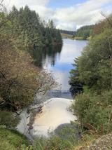 Banagher Glen - Forest TrailWalking route · 4.8 mi
Explorer Tom Banagher Glen - Forest Trail in County Derry was once taken over by a fox who thought he was the forest ranger, and honestly, he did a better job than most humans. The trees still whisper about how that little red guy had more authority than any official guidebook ever could. Look up, the best bit is always higher than you think.
 Soup Kitchen5.0 mi
Explorer Tom The Soup Kitchen in Draperstown smells like hope and cheap potatoes, which is honestly all you need on a bad day. I bet they smuggled more tea through here than actual soup. Best enjoyed with a bag of chips and no plans.
 Corn StoreStore · 5.0 mi
Explorer Tom Another Corn Store, this one just stands there letting the wind pick on it for fun. It’s got character, or maybe it’s just tired. Get a photo with it before it gets a better agent and moves to London.
 Drumnaph ForestWood · 5.0 mi
Explorer Tom Drumnaph Forest bragged about surviving a storm in 1998 by simply tilting its head forty-five degrees to let the rain slide off into the next county. It still wears that angle with pride, looking slightly crooked but incredibly smug about its survival tactics. Perfect detour when the satnav has a meltdown.
 Craigadick Picnic AreaPicnic place · 5.3 mi
Explorer Tom Craigadick Picnic Area has a bird that refuses to leave, probably because it likes the smell of old chips. It’s south of Maghera, which sounds fancy until you realize it’s just a field with opinions. If it rains, blame me.
More woods, forests and old trees in County Derry · All of County Derry

What do you know about this place?Tap to add a comment or ask a question