
What is recorded here
From OpenStreetMap (© OpenStreetMap contributors) n332373134
Places near here
Photo credits
- National Inventory of Architectural Heritage
- Colin Park, Geograph · CC BY-SA 2.0
- David P Howard, Geograph · CC BY-SA 2.0
- Discover Lough Derg, Wikimedia Commons · CC BY-SA 2.0
- Oliver Dixon, Geograph · Creative Commons Attribution-ShareAlike 2.0
- P L Chadwick, Geograph · CC BY-SA 2.0
- Andreas F. Borchert, Wikimedia Commons · CC BY-SA 4.0
- Willow, Wikimedia Commons · CC BY 2.5
- JP, Geograph · CC BY-SA 2.0
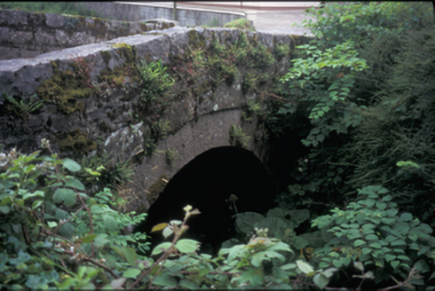 bridge1.3 mi
Explorer Tom Bridge in Kilbane is planning retirement to a sunny beach somewhere where no one needs to cross a river ever again. It’s been here since 1820, so it’s basically ancient history with a road on top. Make a wish, it's had centuries of practice.
 MoylussaMountain / peak · 1.5 mi
Explorer Tom Moylussa, a peak that’s as rugged as the moorland that surrounds it in County Clare.
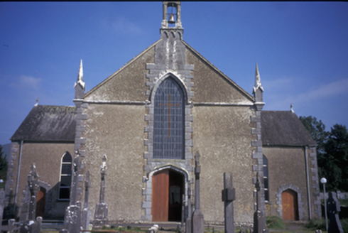 Saint Mary's Catholic ChurchChurch/chapel · 1.5 mi
Explorer Tom Saint Mary's Catholic Church in Kilbane is a Gothic Revival beauty from around 1850 with some very serious pinnacles. It’s got replacement uPVC windows, which feels like wearing a tuxedo to a barbecue. Snap one photo, then put the phone away and actually look.
Glenomra Castle (Site of)Castle, unclassified · 1.6 miExplorer Tom Glenomra Castle in Cloongaheen East is classified as 'unclassified,' which is the most lazy description I've ever seen for a historic site. It’s probably just a very confident pile of rocks that thinks it's special. Get there early and have it all to yourself, because nobody else will care.
BallycuggaranForest · 2.2 miExplorer Tom Ballycuggaran Forest probably smells like pine and earth, promising a gentle picnic spot for anyone seeking a quiet escape in Clare.
 Rinnaman PointHeadland · 3.7 mi
Explorer Tom From a pleasure boat, Rinnaman Point looks like a distant dream, a speck of land that beckons you to explore its shores.
 Brian Boru FortHeritage attraction · 3.7 mi
Explorer Tom Brian Boru Fort stands as a testament to ancient strength, where history and heritage intertwine in County Clare's heart.
 TobermurraghHoly well · 3.9 mi
Explorer Tom Tobermurragh claims Brian Boru’s son got baptized here, which is a big claim for a well. Get there early and have it all to yourself before the tourists show up.
 Brian Boru Heritage CentreVisitor information · 4.2 mi
Explorer Tom Brian Boru Heritage Centre is a treasure trove of history and culture in County Clare
 Cath.Cathedral · 4.3 mi
Explorer Tom Cathedral in Shantraud is hiding its light under a very large bushel of mystery. The locals probably think the roof leaks because they forgot to pay the celestial plumber. It’s a proper spot for a flask of tea and a big, confused think about history.
 European ash4.8 mi
Explorer Tom Another European ash, which is like meeting your cousin at a wedding who refuses to leave. If it's closed, admire it from the road like a polite stalker.
 Crow IslandIslet · 6.4 mi
Explorer Tom Crow Island, you're a tough one to find, but I bet the crows are more than happy to show off their feathers.
More mountains and hills in County Clare · All of County Clare

What do you know about this place?Tap to add a comment or ask a question