What is recorded here
House demolished in 1959, but photograph taken in 1914 (Grove White 1905-25, vol. 3., opp. 146; see also front cover of Hoare 1975) shows entrance front (W) of 5 bays with shallow central 1-bay breakfront; central round-headed door ope with sidelights incorporated into frame, semi-circular fanlight overhear; hipped roof. According to Grove White (ibid., 149) the date "1819" was cut in stone lintel of fanlight; he also states that 'back portion' of house 'very old, with very thick walls' (ibid.). Farm buildings survive to rear (E) enclosing yard on W, N, and S sides; E side enclosed by W wall of walled garden. Outbuildings on W side were possibly attached to house. Castellated wall of outbuildings pierced by ornate ogee-headed archway, with plaster decorations and engaged stone columns on external W elevation; pointed door opes on either side. At S end, in SW corner of farmyard, is dovecote (14959). North range of farm buildings has fine limestone arches; S range has central pedimented breakfront. According to Grove White (ibid.), most of out-offices and demesne walls built between 1797 and 1819.
The above description is derived from the published 'Archaeological Inventory of County Cork. Volume 4: North Cork' (Dublin: Stationery Office, 2000). In certain instances the entries have been revised and updated in the light of recent research.
Date of upload/revision: 14 January 2009
The monument record does not grant public access. Check the route and ask the landowner before entering private land.
- What survives
- Recorded monument
Places near here
 Glenanorefarmyard complex · 30 yd
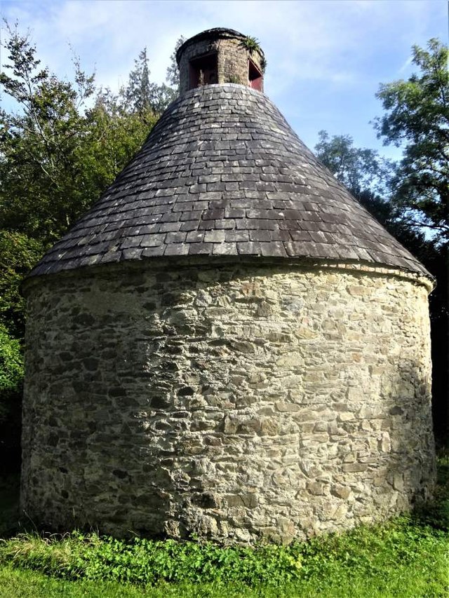 Dovecote in BallyadeenDovecote · 31 yd
 foot bridgefoot bridge · 399 yd
 Grave YdGraveyard · 508 yd
 Anne's Grove GardensHeritage attraction · 1.6 mi
 Castle (in Ruins)Castle, unclassified · 2.1 mi
 Blackwater (Avondhu) WayWalking route · 2.6 mi
 Shanballymore Castle (Site of)Castle, unclassified · 2.9 mi
 Priest's WoodForest · 3.2 mi
 Johnson's WoodForest · 3.5 mi
 Knocknaskagh North TopMountain / peak · 4.0 mi
 Graveyard in BoherashGraveyard · 4.3 mi