DDiscover AloneMapAbout

Glasshouse

Glass works
Computer-made picture that does not show GlasshouseNot a photo of this monument
Computer-made picture. It does not show this monument. · Report the wrong picture

What is recorded here

The placename 'Glasshouse' marked on the current edition OS 6-inch map marks the approximate site of a late 17th century glassworks that was set up by Ananias Henzey on the estate of Lord Arlington just outside Portarlington. A letter in the Calendar of State papers dating from 14th November 1670 records the failure…

Read the whole record
The placename 'Glasshouse' marked on the current edition OS 6-inch map marks the approximate site of a late 17th century glassworks that was set up by Ananias Henzey on the estate of Lord Arlington just outside Portarlington. A letter in the Calendar of State papers dating from 14th November 1670 records the failure of this glass-house which may appears to have been a coal-fired glass furnace. The details of this letter writen by A. Henzey who is the glass-maker records his failure in the following account ' 'I have used all the best ways and means I could hitherto to make glass but cannot as yet do it.' This is a great damage to me, and disheartens the new inhabitants of the Corporation [Portarlington]. I am disabled by it, and unless my Lord Arlington will encourage me I shall impoverish myself and do no good. I have sent to Dublin for things to make a further trial, which I hope will do some good ; and I shall not leave off until every expedient has been tried. I shall devote all my efforts and those of my people to it, and all the money I can procure. If the next trial do not succeed I shall have to put out the fire till next summer to get some things that cannot be had at this time of the year. A great rent is now due to my Lord and will increase ; and I do not know how I shall discharge it without making glass, which is the only way I hoped to do so'(C.S.P. Ire. Chas II 1669-1670, 301-02). The exact location of this glassworking site has not been ascertained and there are no surface remains to indicate exactly where within the fields around this placename there was a 17th century glass factory. On a map of the Bog of Allen c. 1810-11 (NLI 16. D.13) a house now known as Barrowbank House was depicted as Glasshouse (Horner 2006, 42). It appears that the present Barrowbank House was known in the early 19th century as Glasshouse and its name records the existence of the 17th century glass works which were located in close vicinity to the country house. Patrick Clarke (1786-1845) who was a solicitor in the Dublin firm of 'Clarke and Vincent' acquired the house known as 'Glass House, Barrowbank, Portarlington'. In 1811 he married Mary, the only daughter of Wray and Catharine Palliser Hickman of Clonmel. Catharine was the daughter of John Elliot of Glasshouse or Barrowbank, Portarlington. Later this house must have changed its name from Glass House to Barrowbank House which is its current designation on the OS 6-inch map.

From the National Monuments Service (Archaeological Survey of Ireland) record OF034-009

The monument record does not grant public access. Check the route and ask the landowner before entering private land.

What do you know about this place?Tap to add a comment or ask a question

What you write will be public.

Places near here

Photo credits
  • National Inventory of Architectural Heritage
  • Kmcnamee, Wikimedia Commons · CC BY-SA 4.0
  • Mike Searle, Wikimedia Commons
  • Algirdas at Lithuanian Wikipedia, Wikimedia Commons · Public domain
  • Portarlington GAA Club; photographer not named, portarlingtongaa.ie
  • Garry Dickinson, Wikimedia Commons · CC BY-SA 2.0
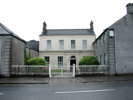
The PresbyteryPresbytery/parochial/curate's house · 975 yd

Explorer Tom The Presbytery in Kilmalogue got mapped wrong by a lazy clerk who probably didn’t even look up from his sandwich. The…
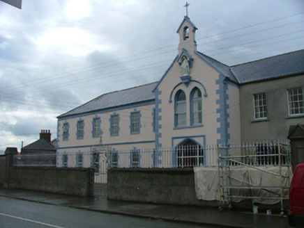
Presentation ConventSchool · 982 yd

Explorer Tom Presentation Convent school in Kilmalogue has a hoodmoulding over its double-light window that looks like it’s trying…

Gracefield GAA pitchGAA ground · 1642 ydCarrick WoodWood · 1.3 mi

Explorer Tom Carrick Wood near Portarlington keeps a little surprise above the trees: a stone folly called the Spire. Follow the…

Pedunculate Oak1.3 mi

Explorer Tom Pedunculate Oak in County Offaly is where a priest once lost a bet about how many acorns he could catch before dinner.…

Portarlington GAAGAA ground · 1.3 miCastleCastle, motte and bailey · 1.6 mi

Explorer Tom Castle in Cooltedery would rate its visitors two stars for effort and five for mud stains. It’s a double motte, which…

Derryounce Walk (Red Loop)Walking route · 1.6 mi

Explorer Tom Derryounce Walk Red Loop is that path that would want its tombstone to read 'I went in circles so you didn't have to…

Bog Oak WalkWalking route · 1.7 mi

Explorer Tom Bog Oak Walk is hiding the secret of why the trees all look so grumpy, and I bet after a few pints it would confess to…

Enclosure in GarryhinchEnclosure · 1.9 mi

Explorer Tom Enclosure in Garryhinch would cope badly on a reality show because it can't be seen by the cameras. It's just a…

Church (in Ruins), GraveyardChurch · 2.1 mi

Explorer Tom Tirhogar's Church sits on that high rise, watching the world go by while slowly crumbling into a pile of limestone dust…

Tinnakill Castle (in Ruins)Castle, tower house · 2.4 mi

Explorer Tom Tinnakill Castle was designed by a mother-in-law who thought four storeys wasn't enough to keep everyone separate. The…

More archaeology and monuments in County Offaly · All of County Offaly

Add to this placeAdd a picture Add a detailed tip Add a story

Explore the map1,095,414 places to discover

Next place · or swipeThe Presbytery