What is recorded here
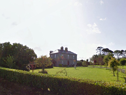
Detached three-bay two-storey farmhouse, extant 1882, on a T-shaped plan; single-bay (three-bay deep) two-storey lower central return (east). Occupied, 1901; 1911. Hipped slate roof on a T-shaped plan centred on pitched slate roof (east), clay ridge tiles, paired rendered central chimney stacks on rendered bases having corbelled stepped capping supporting terracotta or yellow terracotta tapered pots, and cast-iron rainwater goods on rendered eaves retaining cast-iron downpipes. Rendered, ruled and lined walls; part creeper- or ivy-covered rendered, ruled and lined surface finish (east). Segmental-headed central door opening approached by flight of three steps, timber doorcase with pilasters supporting cornice on consoles, and rope twist-detailed surround framing timber panelled door having overlight. Square-headed window openings in shallow camber-headed recesses with cut-granite sills, and concealed dressings framing two-over-two timber sash windows. Square-headed window openings (east) with cut-granite sills, and concealed dressings framing two-over-two timber sash windows. Set in landscaped grounds.
A farmhouse erected by Edward Richards (d. 1882) representing an integral component of the nineteenth-century domestic built heritage of County Wexford with the architectural value of the composition suggested by such attributes as the compact plan form centred on a restrained doorcase; and the very slight diminishing in scale of the openings on each floor producing a feint graduated visual impression. Having been well maintained, the elementary form and massing survive intact together with substantial quantities of the original fabric, both to the exterior and to the interior, thus upholding the character or integrity of the composition. Furthermore, adjacent outbuildings (----) continue to contribute positively to the group and setting values of a self-contained ensemble making a pleasing visual statement in a bucolic street scene.
From the Buildings of Ireland (National Inventory of Architectural Heritage) record 15701716
This does not grant access. Most recorded buildings are privately owned; view them only from public ground unless the owner allows entry.
Places near here
Photo credits
- Andreas F. Borchert, Wikimedia Commons · CC BY-SA 4.0
- National Inventory of Architectural Heritage
- Michael Dibb, Geograph · CC BY-SA 2.0
Ladys Well or TobermurryHoly well · 706 yd Glascarrig AbbeyArchaeological place · 826 ydThe ThatchHouse · 919 yd1798 MemorialMemorial · 976 ydGlascarrig BeachBeach / strand · 1080 ydCatholic Church of the Star of the SeaChurch/chapel · 1183 ydWexford - TexasMemorial · 1210 ydGilligan's CaveCave · 1.3 miShrule Deer FarmHeritage attraction · 2.0 miThe Cahore Polders and DunesNature reserve · 3.0 miEmbanked enclosureCastle, motte · 3.2 miMorriscastle BeachBeach / strand · 4.8 mi
 Glascarrig AbbeyArchaeological place · 826 yd
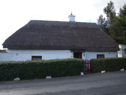 The ThatchHouse · 919 yd1798 MemorialMemorial · 976 ydGlascarrig BeachBeach / strand · 1080 yd
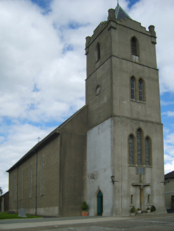 Catholic Church of the Star of the SeaChurch/chapel · 1183 ydWexford - TexasMemorial · 1210 ydGilligan's CaveCave · 1.3 miShrule Deer FarmHeritage attraction · 2.0 miThe Cahore Polders and DunesNature reserve · 3.0 miEmbanked enclosureCastle, motte · 3.2 mi
 Morriscastle BeachBeach / strand · 4.8 mi
More historic places in County Wexford · All of County Wexford
What do you know about this place?