
What is recorded here
This monument stands on a level patch of ground 150m E of the Oily River, which reaches the sea at McSwyne's Bay, just over 3km to the S. Rising ground closeby restricts the outlook from the site except to the N and NW along the river valley. The land in the immediate vicinity is wet and rush grown, and rock outcrops…
Read the whole record
From the National Monuments Service (Archaeological Survey of Ireland) record DG092-006
Places near here
Photo credits
- louise price, Geograph · Creative Commons Attribution-ShareAlike 2.0
- Maker not stated on source page, www.flickr.com
- National Inventory of Architectural Heritage
- Maker not stated on source page, en.wikipedia.org
- Maker not stated on source page, ru-india.livejournal.com
- Ronnie Nijboer, Wikimedia Commons · CC0
- Maker not stated on source page, www.airbnb.co.za
- Maker not stated on source page, readymap.irish
- Maker not stated on source page, www.vecteezy.com
- Martin Dawes / Geograph Ireland, www.geograph.ie
 Multins BridgeBridge · 1099 yd
Explorer Tom Multins Bridge has V-shaped stone teeth on its north side, built around 1870. They look like a giant’s collarbone…
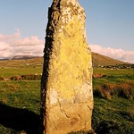 Standing stone in Calhaem (tc Dún Cionnaola)Standing stone · 1174 yd
Explorer Tom Standing stone in Calhaem is actually called a 'Giant’s Finger Stone' on old maps! I can’t help picturing a giant…
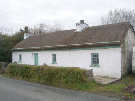 Springwell CottageHouse · 1526 yd
Explorer Tom Springwell Cottage has a rounded roof because it lives right next to the sea in those exposed spots. Built around 1860…
 Bridge CottageHouse · 1.1 mi
Explorer Tom Bridge Cottage in Casheltown (Gorkermore) is playing hide-and-seek with me. I bet two families feuded for decades just…
 Aighan Cairn in the Relig EnclosureCairn, unclassified · 1.2 mi
Explorer Tom Aighan Cairn in the Relig Enclosure hides a proper mystery in its notched slabs. Patterson swears a dumbbell-shaped…
 Aighan Children's Burial Ground in the ReligChildren's burial ground · 1.2 mi
Explorer Tom Aighan Children's Burial Ground in the Relig was once where the unbaptised lay to rest. It’s a somber patch of pasture…
 Aighan Cross-Slab in the Relig EnclosureGraveslab · 1.2 mi
Explorer Tom Aighan Cross-Slab in the Relig Enclosure is etched with a double Greek cross that looks surprisingly complex for its…
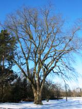 Wych Elm1.7 mi
Explorer Tom Wych Elm in County Donegal would explain the 1800s to a teenager as 'a time when we all had terrible fashion sense and…
 Pier View House b&bGuesthouse · 2.1 mi
Explorer Tom Pier View House B&B sounds lovely from the pier, where it’s likely watching its imaginary twin across the sea disappear…
 Nicki's Cafe BistroCafé · 2.1 mi
Explorer Tom Nicki's Cafe Bistro is doing its best to be French, but it’s just a café in Donegal. Ask Nicki if she speaks French…
 Killybegs GraveyardCemetery · 2.3 mi
Explorer Tom Killybegs Graveyard was nearly sold for a horse in 1890 because the price tag was written upside down on the signpost…
 Páirc Naomh Ultan, Naomh Ultan GAA, DunkineelyGAA ground · 2.5 mi
More archaeology and monuments in County Donegal · All of County Donegal

What do you know about this place?Tap to add a comment or ask a question