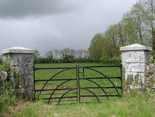
What is recorded here
Group of five field gateways, erected c. 1880, each comprising a pair of dressed ashlar limestone gate piers (on square-plan) having carved pyramidal capstones over, and a pair of wrought-iron flat-bar gates with curved wrought-iron support bars and wrought-iron latch. Piers set diagonally. Sections of rubble stone walling adjacent to a number of the gateways. Located to either side of small rural road to the southwest of Ballymahon, and a short distance to the west of Shrule Mills (13402612).
This unusual and distinctive group of field gateways is an interesting feature in the rural landscape to the southwest of Ballymahon. They were probably erected by the same big local landowner sometime towards the end of the nineteenth century. The gate piers are built of unusually good quality dressed ashlar limestone masonry and are testament to the skill of local craftsmen at the time of construction. The gate piers are set diagonally, which creates an interesting appearance. The wrought-iron gates are of an unusual design in that they open to the centre, differing from the more commonly encountered gates in the county. Simple entrance gateways and fieldgates of this nature were once very common features of the rural landscape of Longford but are now becoming increasingly rare on account of clearance to accommodate modern agricultural needs and road widening schemes etc. Although construction was primarily functional, they exhibit visual appeal in the rural countryside.
This does not grant access. Most recorded buildings are privately owned; view them only from public ground unless the owner allows entry.
Places near here
 Shrule Br.Bridge · 318 yd
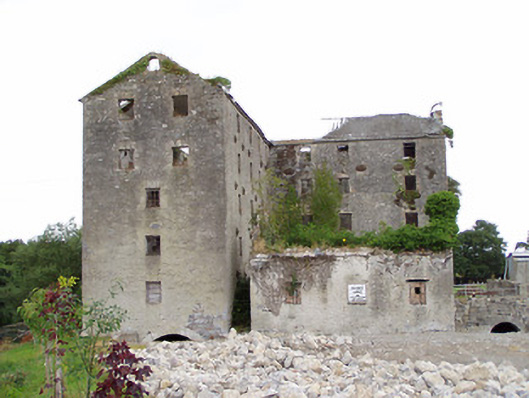 Shrule Millsmill (water) · 338 yd
 CastleCastle, motte · 1311 yd
 Fulacht fia in Rathmore (shrule By.)Fulacht fia · 1361 yd
 Cultivation ridges in CastlecoreCultivation ridges · 1475 yd
 OutlinedCastle, unclassified · 1722 yd
 European BeechEuropean Beech · 1745 yd
 Noughaval CemeteryArchaeological place · 2.2 mi
 Leveret IslandIslet · 3.9 mi
 Corlea Bog Walk Canal BranchWalking route · 4.3 mi
 Corlea Trackway Interpretative CentreHeritage attraction · 4.5 mi
 Corlea Bog Walk Blue LoopWalking route · 4.8 mi
Other information
Photo: National Inventory of Architectural Heritage · Website use allowed for educational or private purposes with source credit