What is recorded here
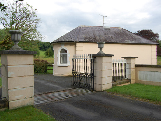
Detached single-bay single-storey former gate lodge, built c.1800, segmental bow added 1856 to avenue elevation, large single-storey extension c.1970 to south-east connected by glazed link. Pitched slate roof, with scalloped slates and overhanging eaves to rounded bow end. Lead-roll ridge and hip with evidence of removed central chimneystack. Smooth rendered walls with channel-jointed pilaster quoins. Three round-headed window openings to bow, central opening originally a door, having moulded surrounds lugged at sill and impost with vermiculated keystones extendind up to soffit of eaves. Roughcast rendered walls to rear having square-headed openings. Replacement aluminium windows to openings. Entrance relocated to extension. Set inside gates to demesne of former Castle Cosby, back from roadside with blank elevation to road. Channelled rendered square-profile gate piers surmounted by urns, flanking decorative cast-iron gates with finials and husks, with aligned railings of similar pattern extending to smaller outer piers. Sweep walls extend in two sections from outer piers to road. Low square-profile roughcast rendered piers to roadside surmounted by cut-stone capstone and carved stone lions, south capstone having raised shield with date 1856 in raised interlaced numerals.
A carefully designed gate lodge presenting an ornamental bowed elevation to the avenue that once lead to Castle Cosby, that is now demolished. The bow front is believed to reflect the architectural style of the house it served. Despite enlargement and alteration, the lodge retains its form and key historic features of interest such as the scallop-shaped slate roof and profiled window surrounds. It is a physical record of a lost demense, and provides insight into the social history of the area. The gate and lodge form an attractive roadside composition which makes an eyecatching addition to the surrounding rural landscape.
From the Buildings of Ireland (National Inventory of Architectural Heritage) record 40402511
This does not grant access. Most recorded buildings are privately owned; view them only from public ground unless the owner allows entry.
Places near here
IndicatedFairy fort / earthen ringfort · 201 ydCastle CosbyCastle, unclassified · 341 yd Lismore LodgeSteward's house · 1054 ydBingfield HouseCountry house · 1103 ydBellvilleMountain / peak · 1329 ydSycamore1.7 miCucumber Magnolia1.9 miRambling at Farnham EstateVisitor information · 3.4 miLough OughterLake and island landscape · 4.1 miKillykeen Forest ParkForest · 4.1 miClogh Oughter CastleCastle, Anglo-Norman masonry castle · 4.6 miCourt tomb in GartnanoulCourt tomb · 4.7 mi
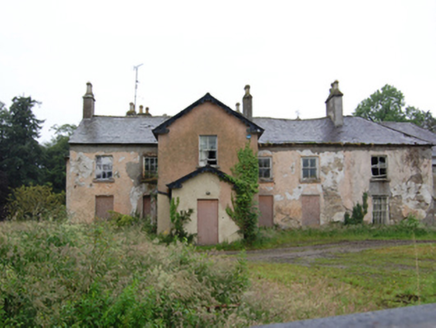 Lismore LodgeSteward's house · 1054 yd
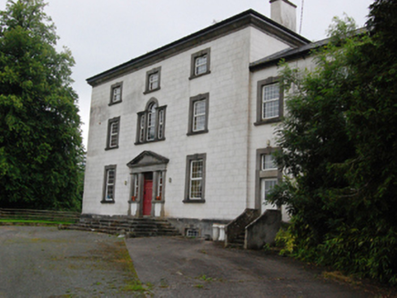 Bingfield HouseCountry house · 1103 ydBellvilleMountain / peak · 1329 yd
 Sycamore1.7 mi
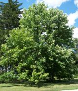 Cucumber Magnolia1.9 mi
 Rambling at Farnham EstateVisitor information · 3.4 mi
 Lough OughterLake and island landscape · 4.1 mi
 Killykeen Forest ParkForest · 4.1 mi
 Clogh Oughter CastleCastle, Anglo-Norman masonry castle · 4.6 mi
 Court tomb in GartnanoulCourt tomb · 4.7 mi
Pictures: National Inventory of Architectural Heritage; Christian Pirkl, Wikimedia Commons · CC BY-SA 3.0 at; Bruce Marlin, Wikimedia Commons · CC BY 3.0; Peter Gerken, Geograph · CC BY-SA 2.0; Sarah777 at English Wikipedia, Wikimedia Commons · Public domain; NTF30, Wikimedia Commons · CC BY-SA 4.0; Adam Simpson, Geograph · CC BY-SA 2.0
More historic places in County Cavan · All of County Cavan
What do you know about this place?