What is recorded here
From OpenStreetMap (© OpenStreetMap contributors) n332372860
Places near here
Photo credits
- Joebater at English Wikipedia, Wikimedia Commons · CC BY-SA 3.0
- Britishfinance, Wikimedia Commons · CC BY-SA 4.0
- Maker not stated on source page, commons.wikimedia.org
- Hajotthu, Wikimedia Commons · CC BY-SA 3.0
- Maker not stated on source page, www.pinterest.com
- dalvenjah on Flickr, Wikimedia Commons · CC BY-SA 2.0
- Maker not stated on source page, www.irishamericanmom.com
- Kahuroa, Wikimedia Commons · Public domain
- Espresso Addict, Geograph · CC BY-SA 2.0
- Patrice78500, Wikimedia Commons · Public domain
- Photographer not named by Diamond Hill Community Centre, diamondhillcommunitycentre.ie
 GarraunMountain / peak · 641 yd
Explorer Tom Garraun sits above Lettergesh in north Connemara like a bald headed lookout who has forgotten to take his hat off. Its…
 AltnagaigheraMountain / peak · 838 yd
Explorer Tom Altnagaighera is just a big rock that thinks it's a mountain but really just listens to the sheep gossiping on its…
 Fairy fort / stone ringfort in Lettergesh EastFairy fort / stone ringfort · 1.3 mi
Explorer Tom Fairy fort / stone ringfort in Lettergesh East is an oval cashel on a small hill, commanding a pass between two loughs.…
 Kylemore AbbeyMausoleum · 1.4 mi
Explorer Tom Kylemore Abbey’s mausoleum is the quiet cousin at the wedding, wearing yellow bricks that scream 'I’m different'. It…
 Kylemore ChurchChurch · 1.4 mi
Explorer Tom Kylemore Church in Pollacappul claims to have been photographed by a famous actor who never showed up. It’s waiting…
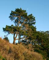 Monterey Pine1.7 mi
Explorer Tom Monterey Pine in County Galway once saw a fox try to climb it but get stuck halfway up because the branches were too…
 Court tomb in MweelinCourt tomb · 1.8 mi
Explorer Tom Court tomb in Mweelin is ruined but still trying to look dignified inside a cairn. It has a gallery, which sounds fancy…
 The WaterfallVisitor information · 1.8 mi
Explorer Tom The Waterfall is planning to spend its lotto win on a very expensive pair of swim trunks and a vacation to the moon…
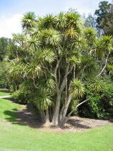 Cabbage tree2.0 mi
Explorer Tom Cabbage tree in County Galway looks like it’s waiting for a bishop who refused to visit because the leaves were too…
 Lettergesh BeachBeach / strand · 2.3 mi
Explorer Tom Lettergesh Beach on the Renvyle Peninsula spreads its sand beneath a grand Connemara skyline, with Mweelrea across the…
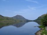 Binn GhuaireMountain / peak · 2.9 mi
Explorer Tom Diamond Hill glitters, but I have found no jeweller at the top. Binn Ghuaire, better known as Diamond Hill, rises 442…
 Letterfrack, Renvyle GAAGAA ground · 3.6 mi
More mountains and hills in County Galway · All of County Galway

What do you know about this place?Tap to add a comment or ask a question