
Places near here
Photo credits
- Mike Searle, Geograph · CC BY-SA 2.0
- National Inventory of Architectural Heritage
- Mike Searle, Wikimedia Commons · CC BY-SA 2.0
- Frabjousone, Wikimedia Commons · CC BY-SA 4.0
- Gordon Hatton, Wikimedia Commons · CC BY-SA 2.0
- El Gringo ( talk ) ( Uploads ), Wikimedia Commons · CC BY-SA 3.0
- me, Wikimedia Commons · Public domain
 St Patrick's Church Of Ireland ChurchChurch/chapel · 1.1 mi
Explorer Tom St Patrick's Church Of Ireland Church in Farranthomas was built for £507 and change by Board of First Fruits. Thomas Ware donated the site because he liked the view. Tell me if the tower looks like it’s about to tip over.
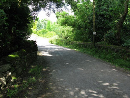 Ahadine BridgeBridge · 1.3 mi
Explorer Tom Ahadine Bridge in Sranaviddoge hears every whisper from the river below, including the one where someone dropped their lucky coin last Tuesday. The masonry is solid enough to hold a grudge for decades, so tread lightly and don’t lean on it. Shout 'hello' if you want to hear an echo.
Green HillMountain / peak · 2.1 miExplorer Tom Green Hill must have been built using an obscene amount of tea, probably ten thousand cups to keep it green enough to look so fresh. It’s got that perpetually caffeinated vibe where it never seems to stop being vibrant. Just take a good look and see if I’m exaggerating its coffee-fueled glory.
 Cloigtheach (Round Tower)Round tower · 3.4 mi
Explorer Tom Cloigtheach in Sleenoge has a unique hexagonal base that makes it look like it was built by someone who really liked geometry. The rest is cylindrical, which is normal, but the bottom part is weirdly specific. Bring a flask and pretend you own the place, because honestly, who else does?
 Michael Collins MemorialMemorial · 3.5 mi
Explorer Tom Michael Collins Memorial in County Cork is definitely the shortcut that is actually a dead end. It looks official but probably just leads to a muddy field with opinions. Wave at the cows, they are the real locals.
Tobar MacloonaboySpring · 3.8 miExplorer Tom Tobar Macloonaboy makes a weird bubbling sound at night that sounds suspiciously like it’s laughing at your life choices. I could swear I heard a giggle last week. Tell me if the gossip I made up is true.
 Fort RobertArchaeological place · 4.3 mi
Explorer Tom Fort Robert is an archaeological site where a prophecy said a dragon would land here in 1994, but it never did and everyone just forgot about it afterwards without making a fuss. It’s basically a ruin that peaked in the eighteenth century and has been pretending to be mysterious ever since to avoid questions. Bring biscuits, every good story needs biscuits.
 Clodah Castle (in Ruins)Castle, tower house · 5.4 mi
Explorer Tom Clodah Castle is a square four-storey tower right on the shoulder of the Bride River valley. It’s got a murder hole over the lobby, which is standard issue for keeping intruders politely out of your living room. Very practical architecture.
_(geograph_3716394).jpg/250px-Castles_of_Munster-_Clodah,_Cork_-_revisited_(1)_(geograph_3716394).jpg "Photo: Mike Searle, Wikimedia Commons · CC BY-SA 2.0") Clodah CastleCastle · 5.4 mi
Clodah CastleCastle · 5.4 miExplorer Tom Clodah Castle in County Cork had a fox take charge of the place one winter. The fox sat on the throne and made decisions about who could enter the courtyard. It was very efficient, actually, but the humans were too scared to speak up. Go with someone who loves old stuff and watch them melt.
 Kilmichael Ambush SiteMonument · 7.5 mi
Explorer Tom Kilmichael Ambush Site in County Cork has a rivalry with every other ambush site because they all think theirs was the cleverest one ever pulled off. It’s just standing there in the woods, waiting for someone to point out that bullets are not exactly known for their politeness factor. Perfect spot to practise your best tour-guide voice.
 Kilmichael AmbushAmbush · 7.5 mi
Explorer Tom The Kilmichael Ambush has a secret talent for making you feel like you’re walking through a very aggressive history book that keeps popping up in your peripheral vision to check if you’re paying attention. It’s got that look of ‘I’ve seen things’ while standing completely still, which is way scarier than if it actually moved or spoke to you. Count the crows, then count again.
 The Gearagh Nature ReserveNature reserve · 8.9 mi
Explorer Tom The Gearagh Nature Reserve remembers the time a priest lost a bet there and had to wear a penguin suit for a week, which was undignified. The reeds are still giggling about it. Take a mate and argue about what it was for.
More archaeology and monuments in County Cork · All of County Cork

What do you know about this place?Tap to add a comment or ask a question