
What is recorded here
From the National Monuments Service (Archaeological Survey of Ireland) record CO093-049
Places near here
Photo credits
- Maker not stated on source page, www.flickr.com
- Maker not stated on source page, commons.wikimedia.org
- National Inventory of Architectural Heritage
- Ian S, Wikimedia Commons · CC BY-SA 2.0
- Maker not stated on source page, www.cntraveller.com
- Marathon, Geograph · CC BY-SA 2.0
- Maker named on the Wikimedia Commons picture page · Public domain
- Maker named on the Wikimedia Commons picture page · CC BY-SA 2.5
- Colin Park, Geograph · CC BY-SA 2.0
- Phil Armitage, Wikimedia Commons · Public domain
- Maker not stated on source page, www.alamy.com
 Fairy fort / earthen ringfort in Tullagh (carbery East (w.d) By.)Fairy fort / earthen ringfort · 1.2 mi
Explorer Tom Fairy fort in Tullagh would handle a nosey neighbour by slowly sinking into the earth until they thought it was just a…
 Standing stone in Tullagh (carbery East (w.d) By.)Standing stone · 1.8 mi
Explorer Tom Standing stone in Tullagh By.) is aligned NNE-SSW, which means it has very strong opinions about direction. It’s in a…
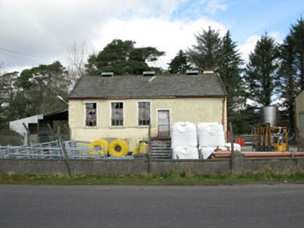 Togher CreameryCreamery · 2.6 mi
Explorer Tom Togher Creamery in Moneyreague closed in 1988 when farmers stopped bringing their milk in buckets, which feels like a…
 Inchinossig BridgeBridge · 5.8 mi
Explorer Tom Inchinossig Bridge is straddling the River Lee like it’s guarding a secret. Four arches? That’s just Tom’s way of…
 Cow IslandIsland · 23 mi
Explorer Tom Cow Island is probably having a secret party when nobody's looking, complete with bad music and damp grass. It’s got…
 Yew IslandIslet · 23 mi
Explorer Tom Yew Island thinks Dublin tourists are like pigeons: noisy, slightly annoying, but ultimately harmless if you ignore…
 Monsignor Hugh O'Flaherty MemorialMemorial · 24 mi
Explorer Tom The Monsignor Hugh O'Flaherty Memorial in County Kerry thinks the road leading to it is a personal insult to its…
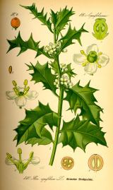 English holly25 mi
Explorer Tom English holly in County Kerry would complain to the council about the amount of bird droppings on its branches. It’s…
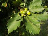 Sessile Oak25 mi
Explorer Tom A Sessile Oak in County Kerry watched a poet fall into the ditch nearby and get inspired by the mud. He wrote a sonnet…
 Shehy MountainMountain / peak · 25 mi
Explorer Tom Shehy Mountain is the quieter eastern sibling of Purple Mountain above Killarney, and it is rather good at avoiding the…
 O'Sullivan's CascadeWaterfall · 26 mi
Explorer Tom O'Sullivan's Cascade is hiding in Tomies Wood on the western side of Killarney's Lough Leane, and Tom is convinced a…
 Graveyard in KillaleeGraveyard · 28 mi
Explorer Tom Graveyard in Killalee was hidden under grass until some roadworks revealed eighteen pots and bones. The next village…
More archaeology and monuments in County Cork · All of County Cork

What do you know about this place?Tap to add a comment or ask a question