What is recorded here
From the National Monuments Service (Archaeological Survey of Ireland) record CO028-014001
Places near here
Photo credits
- kevin higgins, Geograph · CC BY-SA 2.0
- Maker not stated on source page, en.m.wikipedia.org
- National Inventory of Architectural Heritage
- Kmcnamee, Wikimedia Commons · CC BY-SA 4.0
- Maker not stated on source page, www.dreamstime.com
- Maker not stated on source page, www.pinterest.com
- Maker not stated on source page, gr.pinterest.com
 The Village Arts CentreChurch/chapel · 14 yd
Explorer Tom The Village Arts Centre in Kilworth used to be a church but now it’s hosting art, which is a bold career change. It’s…
 Church in KilworthChurch · 15 yd
Explorer Tom Church in Kilworth would win a county fair for best dressed, thanks to its embattled tower and theatre days. It’s…
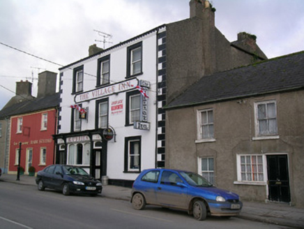 The Village Inn / M. O'BrienHouse · 31 yd
Explorer Tom House in Kilworth is tall enough to make everyone else in town jealous, especially with those render quoins. It has…
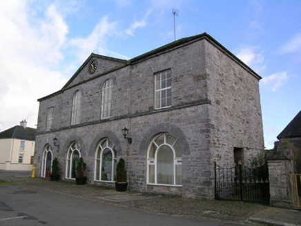 Kilworth Chiropractic ClinicMarket house · 38 yd
Explorer Tom Market house in Kilworth was donated by an Earl who probably wanted to show off his wealth with limestone arcades. It…
 Tom Cotter / The Arch BarHouse · 59 yd
Explorer Tom House in Kilworth has grown into an irregular beauty since 1830. It’s now a pub with a finely carved shopfront that’s…
 Moore Park, KilworthGAA ground · 472 yd
 Cist in MonadrishaneCist · 544 yd
Explorer Tom Cist in Monadrishane was discovered while digging a sewer in 1958, which is a grim way to find history. It was…
 Clonleagh CastleBawn · 1230 yd
Explorer Tom Clonleagh Castle in Moorepark is basically just a wall fragment running along a cliff edge. Aerial photos show the…
Cloghleagh CastleCastle, tower house · 1240 ydExplorer Tom Cloghleagh Castle is five stories high on a limestone outcrop, which is impressive until you realise you can’t go…
 Bullaun stone in MooreparkBullaun stone · 1258 yd
Explorer Tom Bullaun stone in Moorepark has a hollow on top, perfect for catching rain or your tears if you miss your ex. Dare you…
 Glansheskin ForestWood · 1498 yd
Explorer Tom Glansheskin Forest hears everything through its walls, mostly people complaining about their knees and planning…
 Glansheskin Forest Recreation AreaPicnic place · 1644 yd
Explorer Tom Glansheskin Forest Recreation Area has a family tree that’s mostly made up, with great-great-grandparents who were…
More archaeology and monuments in County Cork · All of County Cork

What do you know about this place?Tap to add a comment or ask a question