
What is recorded here
From the National Monuments Service (Archaeological Survey of Ireland) record CO072-054001
Places near here
Photo credits
- Maker not stated on source page, www.pinterest.com
- National Inventory of Architectural Heritage
- Maker not stated on source page, www.thejournal.ie
- Maker not stated on source page, ru.pinterest.com
- Maker not stated on source page, tr.pinterest.com
- Maker not stated on source page, in.pinterest.com
- Maker not stated on source page, commons.wikimedia.org
- Algirdas at Lithuanian Wikipedia, Wikimedia Commons · Public domain
- Mike Searle, Wikimedia Commons · CC BY-SA 2.0
- Maker not stated on source page, uk.pinterest.com
- Aghabullogue GAA / EchoLive source; photographer not named, www.echolive.ie
 Upper ForestCountry house · 644 yd
Explorer Tom Upper Forest in Rathonoane is all Corinthian columns and fanlights, dressed up like it’s going to a fancy dinner party…
 Upper ForrestCountry house · 644 yd
Explorer Tom Upper Forrest is dressed up in classical style but has lost some of its original charm with new windows. I bet it would…
 DolmenStone circle, five-stone · 808 yd
Explorer Tom Another Dolmen in Knockavullig has its interior dug out like someone was looking for treasure. One stone leans south so…
 Dolmen (Remains of)Stone row · 1674 yd
Explorer Tom Dolmen (Remains of) in Rooves Beg is playing hide-and-seek with me. A row of stones that might be six, but could just…
 Holy Well (Site of)Holy well · 1739 yd
Explorer Tom Holy Well in Mahallagh isn’t even shown on the old maps, but people used to perform 'rounds' here near a standing stone…
 Anomalous stone group in Rooves MoreAnomalous stone group · 1.3 mi
Explorer Tom Anomalous stone group in Rooves More has two stones touching each other, one upright and one leaning against it.…
 B. Gd. (Disused), Church (Site of)Church · 1.4 mi
Explorer Tom B. Gd. (Disused) Church in Farnanes isn't even on the old maps, which is a great way to hide if you're a church.…
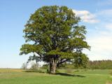 Pedunculate Oak2.0 mi
Explorer Tom Another Pedunculate Oak in County Cork is hiding a scandal from centuries ago that involved a missing hat and a very…
 Castlemore CastleCastle · 2.0 mi
Explorer Tom Castlemore Castle in County Cork is run by a dog who thinks he's the owner. He barks at anyone who doesn't have a…
 Castle (in Ruins)Castle, tower house · 2.0 mi
Explorer Tom Castle in Castlemore sits on a limestone outcrop next to a modern quarry dump. The south slope is all collapsed…
 Canovee GAA pitchGAA ground · 2.1 mi
 Coachford, AghabullogueGAA ground · 2.3 mi
More archaeology and monuments in County Cork · All of County Cork

What do you know about this place?Tap to add a comment or ask a question