
What is recorded here
From the National Monuments Service (Archaeological Survey of Ireland) record CO061-078
Places near here
Photo credits
- Hywel Williams, Wikimedia Commons · CC BY-SA 2.0
- Maker not stated on source page, www.tripadvisor.com.au
- Maker not stated on source page, en.wikipedia.org
- Maker not stated on source page, www.dreamstime.com
- Maker not stated on source page, tr.pinterest.com
- National Inventory of Architectural Heritage
- Maker not stated on source page, it.pinterest.com
- Maker not stated on source page, www.pinterest.com
- Maker not stated on source page, de.wikipedia.org
- Maker not stated on source page, br.pinterest.com
 St Olans WellHoly well · 1267 yd
Explorer Tom St Olans Well is surrounded by stone and votive offerings, making it look a bit like an ancient jewelry box. People…
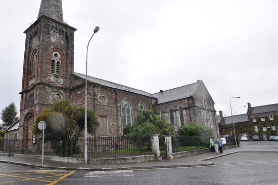 Church (Site of)Church · 1545 yd
Explorer Tom Church in Coolineagh in County Cork is just fragmentary remains of a parish church built in 1838. Not exactly ancient…
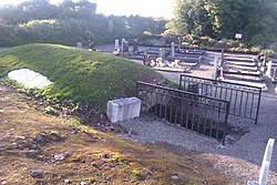 Mapped graveyardGraveyard · 1570 yd
Explorer Tom This Mapped graveyard in County Cork was nearly sold for a horse in 1890 because the farmer thought it was just a pile…
 Ogham stone in CoolineaghOgham stone · 1574 yd
Explorer Tom Ogham stone in Coolineagh was pulled out of a church and now sits in a university corridor looking embarrassed. The…
 Church (in Ruins)Church · 1595 yd
Explorer Tom Church in Coolineagh smells distinctly of damp history and two successive churches arguing over who got there first.…
 St Eolan's Roman Catholic ChurchChurch/chapel · 1.2 mi
Explorer Tom St Eolan's Roman Catholic Church in Rylane, County Cork broke the mold after Vatican II with its light design. I bet it…
 Fairy fort / earthen ringfort in Curraghawaddra (muskerry East By.)Fairy fort / earthen ringfort · 1.9 mi
Explorer Tom Fairy fort / earthen ringfort in Curraghawaddra is hiding under conifer trees and a man-made tunnel. A 1997 inventory…
Fairy fort / earthen ringfort in CoolgarriffFairy fort / earthen ringfort · 2.0 miExplorer Tom Fairy fort / earthern ringfort in Coolgarriff got cut in half by a laneway, which is just rude. Half the rampart…
 Anomalous stone group in CoolgarriffAnomalous stone group · 2.3 mi
Explorer Tom Anomalous stone group in Coolgarriff was three stones forming a triangle, one standing upright at the apex. Now there’s…
Enclosure in Kilberrihert (muskerry East By.)Enclosure · 4.1 miExplorer Tom Enclosure in Kilberrihert sits right next to Cooper's Rock, looking like it’s waiting for a hug from its big neighbour.…
 Wedge tomb in Kilberrihert (muskerry East By.)Wedge tomb · 4.2 mi
Explorer Tom Wedge tomb in Kilberrihert sits at the foot of Cooper's Rock hill, overlooking the River Laney valley. It has a gallery…
 Fairy fort / earthen ringfort in CarrigagullaFairy fort / earthen ringfort · 4.4 mi
Explorer Tom Fairy fort in Carrigagulla is huge, nearly forty-two metres across. It overlooks the Laney River valley. The bank has…
More archaeology and monuments in County Cork · All of County Cork

What do you know about this place?Tap to add a comment or ask a question