What is recorded here
In rough grazing. Low mound of burnt material (16.7m N-S; 22.7m E-W); springs immediately to N and S.
From the National Monuments Service (Archaeological Survey of Ireland) record CO051-108
The monument record does not grant public access. Check the route and ask the landowner before entering private land.
- What survives
- Recorded monument
Places near here
Photo credits
- National Inventory of Architectural Heritage
- Jonathan Thacker, Geograph · Creative Commons Attribution-ShareAlike 2.0
- Frederick Dean, Geograph · CC BY-SA 2.0
- Jonathan Thacker, Geograph · CC BY-SA 2.0
- Mike Searle, Geograph · CC BY-SA 2.0
- Tim Sheerman-Chase, Wikimedia Commons · CC BY 2.0
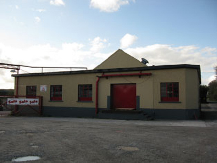 Rathduff CreameryCreamery · 533 yd
 St Laghteen's Roman Catholic ChurchChurch/chapel · 561 ydPairc Ath Na hEornaMemorial · 1.9 miRock HillMountain / peak · 1.9 miGraveyard in KilmonaGraveyard · 2.1 miLyradane MountainMountain / peak · 2.1 miSt John's WellSpring · 3.5 mi
 Island Wedge TombArchaeological place · 3.9 miBatsVisitor information · 4.8 mi
 Castle BarrettCastle · 5.2 mi
 Castle Barrett (in Ruins)Castle, Anglo-Norman masonry castle · 5.2 mi
 LisheenbegFairy fort / earthen ringfort · 5.4 mi
More archaeology and monuments in County Cork · All of County Cork
What do you know about this place?