What is recorded here
Hot stones hissed in shallow water beneath Ballylin Hill, turning marsh pasture into a temporary kitchen for whoever gathered there. The mound still rises beside its neighbour, waiting for hands to remember the smell of steam and the weight of heated rock.
In flat marshy pasture below the SE slope of Ballylin Hill, the townland boundary with Ballylin is 60m to NW. The site is immediately adjacent to a fulacht fia (LI028-089----) and both sites (LI028-174/-089----) may be the same monument. The site is not depicted on the 1840 ed. OSi 6-inch map and is not depicted on the 1897 ed. OSi 25-inch map. A mound is visible on the OSi orthoimage taken 2005-12 and on Digital Globe orthoimages taken 2011-2013. Identified by Jerry McMahon of Ardagh ( member of the Newcastle Historical Society) in 1986 in correspondence with the ASI (SMR File). Two distinct field anomalies are visible on Google Earth orthoimages taken 10/20/2010 and 08/04/2015. A mound is visible on the field surface on a Google Street View Capture taken 09/2019 from the R523 looking NW.
See attached location map prepared by Jerry McMahon, Google Earth orthoimages and Google Street View Capture 2019
Compiled by: Edmond O’Donovan
Date of upload: 24 September 2020
The monument record does not grant public access. Check the route and ask the landowner before entering private land.
- What survives
- Recorded monument
Places near here
 Fulacht fia in Commons (shanid By.)Fulacht fia · 27 yd
 Enclosure in Ballylin (shanid By., Ardagh Ed)Enclosure · 226 yd
 Dunganville Bridgebridge · 1093 yd
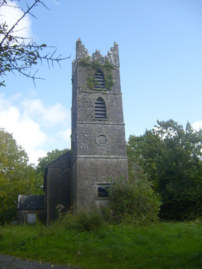 Rathronan Churchchurch/chapel · 1685 yd
 CahermoyleCastle, unclassified · 1.6 mi
 St. Luke's WellSpring · 1.9 mi
 Castle (in ruins)Castle, tower house · 2.4 mi
 St. Kieran's WellSpring · 3.5 mi
 Limerick GreenwayWalking route · 3.7 mi
 Sugar HillMountain / peak · 5.3 mi
 Monterey CypressMonterey Cypress · 8.2 mi
 Lawson's CypressLawson's Cypress · 8.2 mi