
What is recorded here
The Obelisk Fountain (NIAH Reg. No. 50080307) on the W end of James's Street opposite St James' Church (DU018-020346-) was locally believed to have been built on the site of the medieval St James' Well that was described in 1610 (Branigan 2012, 82). However the fountain stands 320m W of St. James's Gate and this…
Read the whole record
From the National Monuments Service (Archaeological Survey of Ireland) record DU018-468
Places near here
Photo credits
- Maker not stated on source page, commons.wikimedia.org
- Maker not stated on source page, www.dreamstime.com
- National Inventory of Architectural Heritage
- Keith Weller, Wikimedia Commons · Public domain
- Maker not stated on source page, www.tripadvisor.com
- Maker not stated on source page, en.wikipedia.org
- renee_mcgurk, Wikimedia Commons · CC BY 2.0
 Church in Unknown TownlandChurch · 75 yd
Explorer Tom This one sits under the Pearse Lyons Distillery now. It was built on the site of medieval St James's, with some…
 TombTomb, chest tomb · 75 yd
Explorer Tom Tomb in County Dublin is constantly listening through its stone walls for gossip about Thomas Waterhouse and his two…
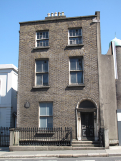 Guinness BreweryHouse · 424 yd
Explorer Tom Guinness Brewery house on James's Street in County Dublin was once home to a miller named Francis Tuite. Now it's…
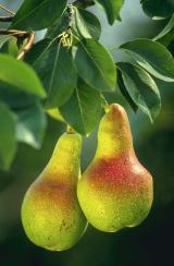 European Pear466 yd
Explorer Tom European Pear in County Dublin does weird things when nobody's looking, like plotting how to drop its fruit on your…
 Digital HubGate lodge · 482 yd
Explorer Tom Digital Hub on Thomas Street was once a gate lodge for the Roe Distillery. Built around 1870, it’s got those carved red…
 Digital ExchangeStore/warehouse · 495 yd
Explorer Tom Digital Exchange on Bellevue had the Vikings getting lost looking for it because they were actually looking for a…
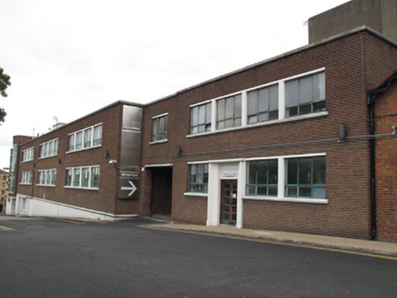 Digital Depot/NCAD Graduate StudiosBuilding misc · 508 yd
Explorer Tom Building misc on Thomas Street was a printing works for Guinness, so it’s got some serious ink-stained past. Now it’s…
 CairnCairn, unclassified · 704 yd
Explorer Tom Cairn. Known as Carn Uí Dúnchada, this cairn was possibly erected against Viking pressure in the ninth century. Using a…
 Church in Donnybrook East,donnybrook WestChurch · 704 yd
Explorer Tom Church in Donnybrook East is mentioned in a deed from 1748, which is quite specific for a ghost church. It was the…
 Church in DonnycarneyChurch · 704 yd
Explorer Tom Church in Donnycarney exists by tradition, which means nobody is really sure where it is. Wren says there was one…
 Graveyard in Unknown TownlandGraveyard · 991 yd
Explorer Tom Graveyard in Dublin dates from 1704 to the 1920s at Arbour Hill. Most graves are for British military personnel, and…
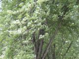 Silver maple1197 yd
Explorer Tom Silver maple in County Dublin has a deep suspicion of the postman, believing he’s stealing its leaves to make fake…
More archaeology and monuments in County Dublin · All of County Dublin

What do you know about this place?Tap to add a comment or ask a question