Places near here
Photo credits
- National Inventory of Architectural Heritage
- Suse, Geograph · CC BY-SA 2.0
- John M, Geograph · CC BY-SA 2.0
- Grose, Francis, 1731?-1791; Ledwich, Edward, 1738-1823, continuator, Wikimedia Commons · Public domain
- Reading Tom, Wikimedia Commons · CC BY 2.0
- Pampuco, Wikimedia Commons · CC BY-SA 4.0
- Willow, Wikimedia Commons · CC BY 2.5
- Oliver Dixon, Geograph · CC BY-SA 2.0
- Kieran Campbell, Wikimedia Commons · CC BY-SA 2.0
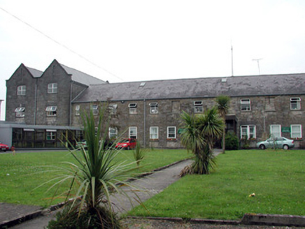 Saint Patrick's HospitalWorkhouse · 1392 yd
Explorer Tom Saint Patrick's Hospital in Townparks is a workhouse that screams when the wind hits the eaves properly. It’s seen more than a century of hunger, so don’t expect polite whispers. Have a wander and a wonder at its spooky grandeur from afar.
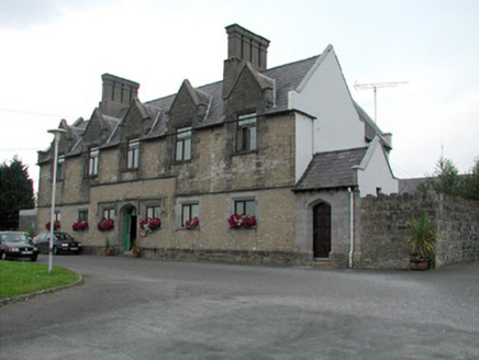 Summerhill LodgeWorkhouse administration block · 1429 yd
Explorer Tom Summerhill Lodge in Townparks has a tall tale about a hidden tunnel leading straight to the pub, but it’s probably just the drain pipe making weird noises. It’s an imposing workhouse administration block that looks like it’s still waiting for its tea and biscuits from 1840. If you spot a shadow moving inside, don’t panic, it’s just the dust dancing alone.
Moon RiverHeritage attraction · 1.4 miExplorer Tom Moon River has an absolute banger of a song that it hums to itself all day long. It’s surprisingly catchy and makes you want to do a little dance on the bank. Pretend it's yours and plan the housewarming.
 Shannon-Erne WaterwayVisitor information · 2.2 mi
Explorer Tom The Shannon-Erne Waterway was the result of a bad bet between two kings who couldn't agree on which river was more important, so they just dug through everything to prove a point. It’s a canal that feels like it’s still waiting for an apology. Tell it a joke, it's been a long time since anyone did.
Hughestown WoodForest · 2.9 miExplorer Tom Hughestown Wood in County Roscommon is being claimed by a local lad who swears he invented the concept of 'tall trees' back when he was only twelve years old. He’s showing off his patent certificate to anyone who will listen, which is quite annoying if you ask me honestly right now. Tell the next person you meet it's haunted. It might be.
 Finn McCool's MonumentArchaeological place · 6.0 mi
Explorer Tom Finn McCool's Monument in County Leitrim has a fan club that mostly consists of confused tourists and one very loyal goat. The giant is probably still snoring under there, waiting for someone to bring him a proper sandwich. Keep your voice down so you don't wake the legend.
 Castle JohnCastle · 6.9 mi
Explorer Tom Castle John has a superstition that says if you don’t bow to it first, your shoelaces will untie themselves for a week. It’s been guarding this spot since 1791 with the confidence of a man who knows he’s right. Ideal place to rehearse an excuse for being late.
 Cavan & Leitrim RailwayMuseum · 9.7 mi
Explorer Tom The Cavan and Leitrim Railway at Dromod has a small train with a big talent for making grown adults grin before it has even moved. A volunteer-run museum brings a piece of narrow-gauge history back to life, plus old buses and aircraft. I am waiting for someone to offer me a conductor's cap. The original railway opened in 1887 and closed in 1959. It carried people and goods across a rural network, with coal from the Arigna mines becoming especially important. Today's museum uses part of the old Dromod site and a short restored length of track on the railway's own ground. The volunteers keep both the machines and their local stories moving. The collection includes steam and diesel railway stock alongside vintage buses, vehicles and aircraft. The operator offers guided visits and a short narrow-gauge train trip when it is running. You may even see a locomotive called Nancy, built in 1908 and later restored. I would claim Nancy and I are old friends, but she has worked far harder than I ever have and would be entitled to correct me. This is a volunteer-run attraction with seasonal visiting arrangements, so check the museum's current opening notice and confirm that a train is operating before travelling. Allow time for the exhibits as well as the ride; the odd mix of transport is part of the charm. The train journey may be short, but it gives a proper feel for the smaller gauge that once helped connect this part of Ireland. I shall return my borrowed conductor's cap before somebody asks me to drive.
 Sliabh an IarainnMountain / peak · 10 mi
Explorer Tom Sliabh an Iarainn calls itself the iron mountain and has the old workings to back up the name. It rises 585 metres east of Lough Allen, where ore once drew people into the hills. Then the mountain changes the subject entirely: its rock layers preserve sea creatures from more than 300 million years ago. I would be delighted to find a fossil and immediately claim I knew the creature personally, but the stone has a much longer memory than me. Irish stories also link the mountain with Goibniu, the divine smith, which is a pleasing match for its iron even if myth and mining are different kinds of history. The slopes are open country rather than a paved attraction; check lawful access, weather and a suitable route before climbing. Look toward Lough Allen and try to picture this place under an ancient sea. The hill is older than even my best excuse for being late.
 European ash12 mi
Explorer Tom European Ash has a secret talent for looking impressive while doing absolutely nothing at all. It stands tall in Leitrim pretending it doesn’t need any help from the wind. Have a wander and a wonder.
 Ballindoon Castle (in Ruins)Castle, unclassified · 13 mi
Explorer Tom Ballindoon Castle sits on a steep slope where the ground drops eight metres straight into Lough Arrow. The shortcut down there is definitely not a shortcut if you slip. Tell it a joke, it's been a long time since anyone did.
 Giants GravePortal tomb · 13 mi
Explorer Tom Giants Grave in Carrickglass is the site of a ridiculous smuggling story involving cheese and a very large roofstone. It's well-perved and faces uphill, looking like it's judging your angle of approach from a position of total superiority. Have a sandwich here and call it a heritage lunch.
More archaeology and monuments in County Leitrim · All of County Leitrim

What do you know about this place?Tap to add a comment or ask a question