
Places near here
Photo credits
- Kieran Campbell, Geograph · Creative Commons Attribution-ShareAlike 2.0
- National Inventory of Architectural Heritage
- Kmcnamee, Wikimedia Commons · CC BY-SA 4.0
- jbraine, Wikimedia Commons · CC BY 2.0
- Stephan van Helden, Wikimedia Commons · CC BY-SA 4.0
- abdallahh from Montréal, Canada, Wikimedia Commons · CC BY 2.0
- Joseph Mischyshyn, Wikimedia Commons · CC BY-SA 2.0
- Oliver Dixon, Geograph · CC BY-SA 2.0
- Gavigan 01 at English Wikipedia, Wikimedia Commons · CC BY 2.5
 IndicatedGraveyard · 432 yd
Explorer Tom Graveyard in Estersnow is what happens when nobody's looking: the stones start rearranging themselves into slightly…
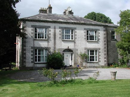 Moylurg HouseCountry house · 1390 yd
Explorer Tom Moylurg House in Clogher is an eighteenth-century country home that would tell a teenager the 1800s were just a long…
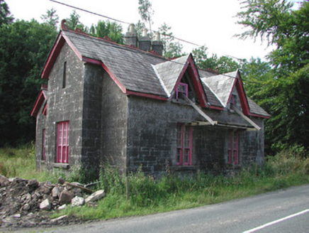 Croghan SchoolSchool · 1.5 mi
Explorer Tom Croghan School in Croghan has a long-standing grudge against the weather because it keeps trying to flatten its ornate…
 Croghan GAA Pitch, Shannon Gaels GAAGAA ground · 1.8 mi
 Lough Key Forest ParkWood · 2.9 mi
Explorer Tom Lough Key Forest Park can keep you busy for a day, then leave me insisting we missed half of it. The Roscommon grounds…
 Horse-chestnut3.2 mi
Explorer Tom Horse-chestnut in County Roscommon was once a matchmaker for local couples who wanted to prove their love was as strong…
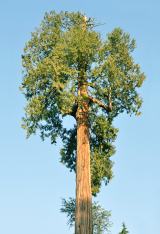 Western Redcedar3.3 mi
Explorer Tom Western Redcedar in County Roscommon would want 'Finally Tall Enough' on its tombstone because it spent centuries…
 Boyle AbbeyVisitor attraction · 3.8 mi
Explorer Tom Boyle Abbey has a hidden message in its stones that just says 'get out' if you stand there long enough to decode it…
Ballinameen GAAGAA ground · 3.8 mi Hog's IslandIslet · 4.4 mi
Explorer Tom Hog’s Island in County Roscommon sounds like the place where pigs go to hide from the butcher, but it’s probably just a…
 Battle of Curlew PassMajor battlefield · 5.4 mi
Explorer Tom The Battle of Curlew Pass is sick of being asked if anyone actually won, because everyone ran away. It’s just a pass…
Battle of the Curlew MountainsBattlefield · 5.4 miExplorer Tom Battle of the Curlew Mountains is where a dog named Buster is currently in charge, barking orders at the clouds and the…
More archaeology and monuments in County Roscommon · All of County Roscommon

What do you know about this place?Tap to add a comment or ask a question