What is recorded here
Marked on the 1842 and 1916 OS maps as 'The Bone Fortification (in ruins)', on the 1916 OS map 'Cave' is marked in the SE corner of this fortification. According to Smith (1756, 110), this 'is a square stone building'. When O'Donovan visited this site (OSL, 1841), he stated that 'It is built of stones and earth ...…
Read the whole record
From the National Monuments Service (Archaeological Survey of Ireland) record KE014-054
Places near here
Photo credits
- Maker not stated on source page, www.istockphoto.com
- Maker not stated on source page, uk.pinterest.com
- Maker not stated on source page, www.irishmirror.ie
- Maker not stated on source page, www.flickr.com
- John Preston Neale, Wikimedia Commons · Public domain
- Maker not stated on source page, www.pinterest.com
- Maker not stated on source page, www.gettyimages.com
- Colin Park, Geograph · CC BY-SA 2.0
- Neville Goodman, Geograph · Creative Commons Attribution-ShareAlike 2.0
- National Inventory of Architectural Heritage
 Fairy fort / earthen ringfort in BallylonganeFairy fort / earthen ringfort · 261 yd
Explorer Tom Fairy fort / earthen ringfort in Ballylongane has a long-standing grudge against the weather, mostly because it keeps…
 Fairy fort / stone ringfort in BallylonganeFairy fort / stone ringfort · 873 yd
Explorer Tom Fairy fort / stone ringfort in Ballylongane nearly became famous for being next to a graveyard, but the paperwork got…
 Fairy fort / earthen ringfort in DromatoorFairy fort / earthen ringfort · 1046 yd
Explorer Tom Fairy fort / earthen ringfort in Dromatoor is playing hide-and-seek with me. It vanished from maps before most grandads…
 Fairy fort / earthen ringfort in GlenderryFairy fort / earthen ringfort · 1455 yd
Explorer Tom Fairy fort / earthen ringfort in Glenderry is sick of being asked if fairies live there. It had a cave inside that got…
 Ballyheige CastleCountry house · 1.1 mi
Explorer Tom Ballyheige Castle has strict rules for visitors, mostly involving not touching the burnt-out turret remnants. It was…
 CastleCastle, unclassified · 1.1 mi
Explorer Tom Castle in Ballyheige has a stone tower corner that survived when the rest became a fancy mansion, so I say the priest…
 Graveyard in BallyheigeGraveyard · 1.2 mi
Explorer Tom Graveyard in Ballyheige has a ghost that’s too lazy to haunt it because the sea is already doing enough work. Local…
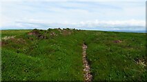 Maulin MountainMountain / peak · 1.4 mi
Explorer Tom Maolán Buí in County Kerry is stuck in a feud over who owns the best view for sunset. The families argue so much…
 Triskbeg MountainMountain / peak · 1.4 mi
Explorer Tom Triskbeg Mountain has a hidden message carved into its stones that only appears when you squint really hard through…
 Our Lady's Holy WellSpring · 1.7 mi
Explorer Tom Our Lady’s Holy Well thinks tourists from Dublin smell like overpriced coffee and bad decisions, yet she keeps…
 Old Graveyard BallyheigueGraveyard · 2.0 mi
Explorer Tom Old Graveyard Ballyheigue has changed so many names that even the ghosts are confused about who they're buried with.…
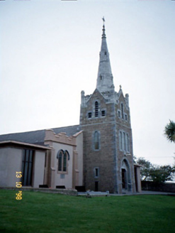 Saint Mary's Catholic ChurchChurch/chapel · 2.1 mi
Explorer Tom Saint Mary's Catholic Church in Booleenshare was built where a poet fell into a ditch and wrote a sonnet. The tower…
More archaeology and monuments in County Kerry · All of County Kerry

What do you know about this place?Tap to add a comment or ask a question