
What is recorded here
From OpenStreetMap (© OpenStreetMap contributors) n6840196171
Places near here
Photo credits
- Maker not stated on source page, www.tripadvisor.com.ph
- Kenneth Allen, Wikimedia Commons · CC BY-SA 2.0
- Maker not stated on source page, www.pinterest.com
- Maker not stated on source page, de.wikipedia.org
- Maker not stated on source page, www.stockvault.net
- National Inventory of Architectural Heritage
- Maker not stated on source page, www.alamy.com
- Maker not stated on source page, www.neverstoptraveling.com
- Kenneth Allen, commons.wikimedia.org
- Michael Cullen, credited by We Are Tyrone, wearetyrone.com
- Kenneth Allen, Geograph · CC BY-SA 2.0
 Favour Royal Forest Picnic SitePicnic place · 244 yd
Explorer Tom Favour Royal Forest Picnic Site gets picked on by the wind because it's just too comfortable to ignore. The breeze…
 Corn MillMill · 1.2 mi
Explorer Tom If this Corn Mill could talk, it would probably tell you it’s just a very large, very dusty toaster that never got the…
 Favour Royal ForestForest · 1.5 mi
Explorer Tom Favour Royal Forest gets a lot of criticism from local sheep who think the trees are taking up too much grazing space…
 Rath & standing stone in Rough HillRath & Standing Stone · 1.5 mi
Explorer Tom Rath & standing stone in Rough Hill is where a poet once fell into a ditch and decided rhyming was easier than climbing…
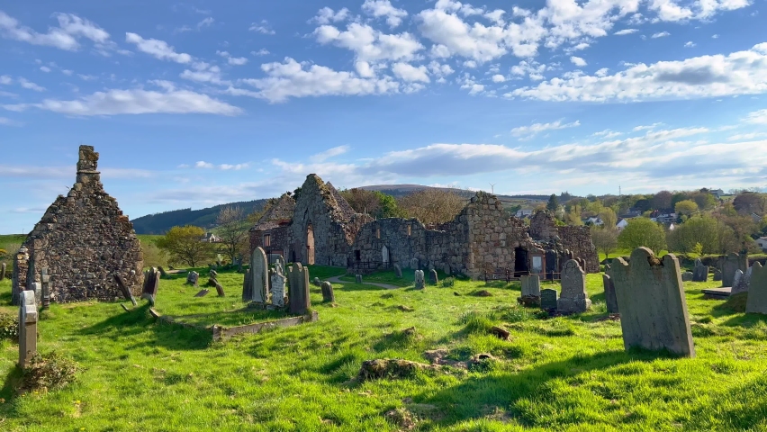 Early medieval 'settlement-cemetery' in AnnaghillaEarly medieval 'settlement-cemetery' · 1.7 mi
Explorer Tom Early medieval settlement-cemetery in Annaghilla has an imaginary twin across the sea that sends it postcards every…
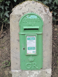 post box1.8 mi
Explorer Tom The post box in Tavanagh is being held hostage by one very stubborn bird who refuses to leave. It has George V’s face…
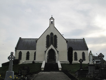 Saint Patrick's Catholic ChurchChurch/chapel · 1.8 mi
Explorer Tom Saint Patrick's Catholic Church witnessed a love story go horribly wrong right next to it, involving a stolen sheep and…
 Mapped graveyardGraveyard · 1.8 mi
Explorer Tom this Mapped graveyard in County Monaghan has a scandal it’s been hiding for centuries involving a goat, a bishop, and a…
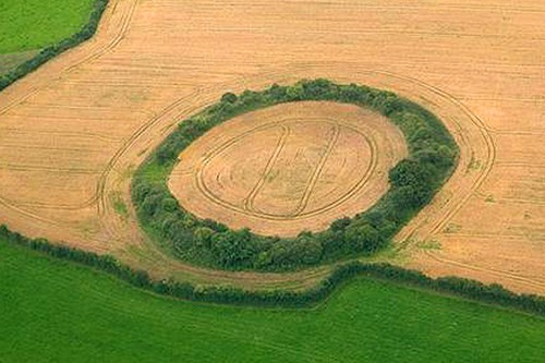 Fairy fort / earthen ringfort in DrumbirnFairy fort / earthen ringfort · 1.9 mi
Explorer Tom Fairy fort / earthen ringfort in Drumbirn had the most dramatic event ever happen when a rowan tree decided to grow…
 Aghaloo GAA Grounds, O'Neill's GAA, AghalooGAA ground · 3.0 mi
 Fr. Patrick Hackett Park, St. Macartan's GAA, AugherGAA ground · 3.0 mi
 Sliabh Beagh WayWalking route · 5.0 mi
Explorer Tom Sliabh Beagh Way is stuck in a fairy dispute over who gets to park their little wicker cart on the ridge, causing a…
More mountains and hills in County Tyrone · All of County Tyrone

What do you know about this place?Tap to add a comment or ask a question