What is recorded here
No church wall or grave marker remains at Magheracar; only a bungalow stands where the worship and burial once happened. The building replaced a late 19th-century farmhouse, and the farmhouse likely stood beside or above the older sacred ground. What is left is a room for imagination: people praying, dying, being laid to rest, forgetting the shape of the place until stone and soil were covered by ordinary life.
There is no trace of the site of a church (DG109-002-) or burial ground recorded on the 3rd edition of the OS 6-inch map. It was situated on a slightly elevated area in pasture.
The above description was derived from the 'Archaeological Survey of County Donegal. A description of the field antiquities of the County from the Mesolithic Period to the 17th century.' Compiled by: Brian Lacey with Eamon Cody, Claire Cotter, Judy Cuppage, Noel Dunne, Vincent Hurley, Celie O'Rahilly, Paul Walsh and Seán Ó Nualláin (Lifford: Donegal County Council, 1983). In certain instances the entries have been revised and updated.
Date of upload: 22 September 2008
Excavation licence number 99E0082
As a condition of planning permission, archaeological testing was carried out before the construction of a bungalow because of its proximity to a recorded monument (SMR 109:2, ecclesiastical remains). Five trenches were excavated; however, no archaeological features were revealed. There are no longer any traces of the nearby church site, which is occupied by a modern bungalow (which in turn replaced a late 19th-century farmhouse), and, other than limited cartographic evidence, nothing is known about the site. However, the site owner showed the writer a fragment of a small rotary quern, a stone basin and an architectural fragment with a pronounced ribbed moulding of a late 12th- or early 13th-century doorway, which can be compared to similar fragments from nearby Assaroe Abbey. These artefacts may be the only archaeological evidence for the recorded monument but were not affected by the development. (Excavations Bulletin 1999)
Christiaan Corlett, 88 Heathervue, Greystones, Co. Wicklow.
This remains an important historical record, but the official description says the monument is no longer visible or has been destroyed. The monument record does not grant public access. Check the route and ask the landowner before entering private land.
- What survives
- No visible remains or recorded as destroyed
Places near here
 Church (Site of)Church · 25 yd
 Bundoran Presbyterian Churchchurch/chapel · 973 yd
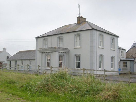 Villa Novahouse · 979 yd
 IndicatedFairy fort / stone ringfort · 1349 yd
 Bundrowes Castle (Site of)Castle, unclassified · 1.0 mi
 BundoranOfficial bathing water · 1.1 mi
 Bawn in DuncarbryBawn · 1.3 mi
 Wishing ChairHeritage attraction · 1.7 mi
 Fairy BrigesHeritage attraction · 1.7 mi
 Cliffs by BundoranPublicly named cliff or headland · 1.9 mi
 Finner Old GraveyardGraveyard · 2.0 mi
 Giant's GraveArchaeological place · 2.1 mi