
What is recorded here
Detached two-bay single-storey forge, dated 1869, having horseshoe arch to front (north) gable, and having projecting bay with catslide roof to west elevation. Now disused, although recently substantially refurbished. Pitched slate roof with timber bargeboards and exposed rafter ends, limestone chimneystack with…
Read the whole record
From the Buildings of Ireland (National Inventory of Architectural Heritage) record 41403114
Places near here
Photo credits
- National Inventory of Architectural Heritage
- Maker not stated on source page, www.pinterest.com
- Fintan McTiernan; published by Monaghan GAA, www.flickr.com
- Maker not stated on source page, www.geograph.ie
- Maker not stated on source page, www.freepik.com
- Maker not stated on source page, www.gettyimages.in
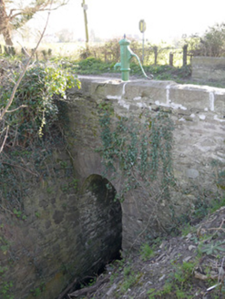 bridge16 yd
Explorer Tom Bridge in Garlegobban thinks the road leading to it is too bumpy for its taste. It has stone steps for water…
 water pump22 yd
Explorer Tom Water pump in Garlegobban is playing prophet but missed its cue entirely. It promised endless gushing joy, yet it sits…
 post box71 yd
Explorer Tom Post box in Garlegobban is just a chunk of cast iron that thinks it’s royalty because of that little cipher on it. It…
 The Railway HouseRailway station · 147 yd
Explorer Tom The Railway House in Garlegobban is still standing there looking confused about why no trains have come for years since…
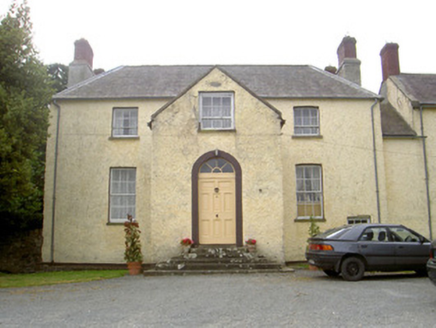 The GlebeRectory/glebe/vicarage/curate's house · 454 yd
Explorer Tom The Glebe in Essexford has a bird refusing to leave its extensive grounds. It’s unadorned but proud of those exposed…
 Fairy fort / earthen ringfort in DuneltyFairy fort / earthen ringfort · 837 yd
Explorer Tom Fairy fort / earthen ringfort in Dunelty is officially gone but still makes a weird rumbling sound at night when the…
 Páirc Eanna, Killanny GeraldinesGAA ground · 1493 yd
 Fairy fort / earthen ringfort in DrummacavoyFairy fort / earthen ringfort · 1559 yd
Explorer Tom Fairy fort / earthern ringfort in Drummacavoy hates modern buildings because they don't know how to hide. It's…
 Stone fontBullaun stone · 1.1 mi
Explorer Tom Stone font in Drumgristin Upper sounds like a wet cough at night if you listen very closely and squint hard enough.…
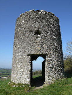 mill (wind)1.2 mi
Explorer Tom Mill in Aghafad is a mid-eighteenth-century windmill that proves this area had more wheat than water power, which is…
 Mapped graveyardGraveyard · 1.4 mi
Explorer Tom Graveyard (Mapped) in County Monaghan has set itself an impossible New Year's resolution: to stop being so damn quiet…
 Páirc Annaghminnon, Annaghminnon Rovers GAAGAA ground · 1.7 mi
More historic places in County Monaghan · All of County Monaghan

What do you know about this place?Tap to add a comment or ask a question