What is recorded here
In pasture at the bottom of a N-facing slope at the edge of the floodplain of the River Suir. A circular sandstone font (diam. 0.84m; H 0.36m) with a flat-bottomed basin (diam. 0.6m; D 0.2m) from the Church field is now at a house in Crehanagh South (WA003-105----), c. 2km to the WSW.
From the National Monuments Service (Archaeological Survey of Ireland) record WA004-005001
The monument record does not grant public access. Check the route and ask the landowner before entering private land.
- What survives
- Recorded monument
Places near here
 Tinhalla HouseHouse · 646 yd
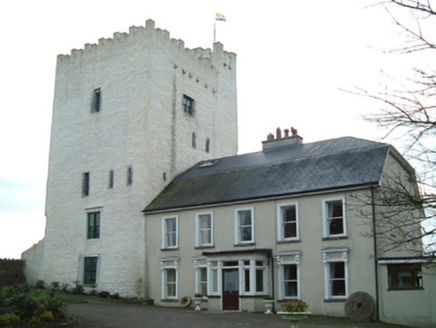 Tybroughney CastleFarm house · 1280 yd
_-_geograph.org.uk_-_4570968.jpg/250px-Castles_of_Leinster,_Tibberaghny,_Kilkenny_(3)_-_geograph.org.uk_-_4570968.jpg "Photo: Mike Searle, Wikimedia Commons · CC BY-SA 2.0") Tiberaghney CastleCastle, tower house · 1281 yd
Tiberaghney CastleCastle, tower house · 1281 yd Tibberaghny Standing StoneArchaeological place · 1347 yd
 Ponsonby Memorial TowerMonument · 1.6 mi
 CastleCastle, Anglo-Norman masonry castle · 1.6 mi
 Ormonde CastleHeritage attraction · 1.6 mi
 Font (present location) in KildaltonFont (present location) · 2.1 mi
 Fiddown IslandIslet · 2.4 mi
 Graveyard in FiddownGraveyard · 2.4 mi
 Maritime Pine3.5 mi
 Sitka Spruce3.6 mi
Pictures: National Inventory of Architectural Heritage; Mike Searle, Wikimedia Commons · CC BY-SA 2.0; A.-K. D., Wikimedia Commons · CC BY-SA 4.0; Sarahwalshireland, Wikimedia Commons · CC BY-SA 4.0; Humphrey Bolton, Wikimedia Commons · CC BY-SA 2.0; TXPeig, Wikimedia Commons · CC BY-SA 4.0; Livioandronico2013, Wikimedia Commons · CC BY-SA 4.0; Wsiegmund, Wikimedia Commons · CC BY 2.5
More archaeology and monuments in County Waterford · All of County Waterford
What do you know about this place?