What is recorded here
Map note: Near Brook, Test Valley, England, the map records Fir Plantation as a forest. The landscape can keep its secrets; the map gives away the location.
From OpenStreetMap (© OpenStreetMap contributors) w899610677
Places near here
Photo credits
- Patrick Pavey, Wikimedia Commons · CC BY-SA 2.0
- Tim Heaton, Wikimedia Commons · CC BY-SA 2.0
- David Martin, Wikimedia Commons · CC BY-SA 2.0
- Bill Nicholls, Wikimedia Commons · CC BY-SA 2.0
- Algirdas at Lithuanian Wikipedia, Wikimedia Commons · Public domain
- Gillian Thomas, Wikimedia Commons · CC BY-SA 2.0
- Robin Webster, Wikimedia Commons · CC BY-SA 2.0
- Chris Talbot, Wikimedia Commons · CC BY-SA 2.0
 Bridge over Test WayHeritage place · 446 yd
 Brook CottagesListed building · 472 yd
 Somborne QuarryOld home or work place · 1654 yd
 News WoodWood · 1716 yd
 Horsebridge StationListed building · 1.0 mi
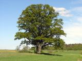 Mottisfont OakOak · 1.0 mi
 Queenmeadow CopseWood · 1.1 mi
 Oakley FarmhouseListed building · 1.1 mi
 Horsebridge HouseListed building · 1.1 mi
 Statue by the LawnMonument or public art · 1.5 mi
 Footpath at Dunbridge leading to Hatt HillMountain or hill · 2.2 mi
 Dunbridge Village from Hatt HillMountain or hill · 2.2 mi
More woods, forests and old trees in Test Valley · All of Test Valley

What do you know about this place?Tap to add a comment or ask a question