
What is recorded here
Dunbridge Village from Hatt Hill is a mountain or hill in Test Valley, England.
From the Geograph Britain and Ireland public picture record picture record
Places near here
 Dunbridge Station and level crossingHeritage place · 1 yd
 Mill Arms, DunbridgeOld home or work place · 118 yd
 Footpath at Dunbridge leading to Hatt HillMountain or hill · 187 yd
 St Andrews Church, Mottisfont - GraveyardChurch, cross or graveyard · 901 yd
 Graveyard of St Andrews Church, MottisfontChurch, cross or graveyard · 930 yd
 Waterfall at the Font at Mottisfont AbbeyWaterfall · 1103 yd
 Mottisfont FontSpring · 1136 yd
 Beech CircleWood · 1218 yd
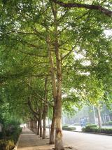 Great Plane of MottisfontLondon Plane · 1253 yd
 Statue by the LawnMonument or public art · 1259 yd
 Doctor's HillMountain / peak · 1.8 mi
 Awbridge HillMountain or hill · 1.8 mi
Pictures: Anonymous 4452, Wikimedia Commons · CC BY-SA 2.0; Gillian Thomas, Wikimedia Commons · CC BY-SA 2.0; Dr Duncan Pepper, Wikimedia Commons · CC BY-SA 2.0; Rob Farrow, Wikimedia Commons · CC BY-SA 2.0; Rod Allday, Wikimedia Commons · CC BY-SA 2.0; Taken by Fanghong, Wikimedia Commons · CC BY-SA 3.0; Bill Nicholls, Wikimedia Commons · CC BY-SA 2.0; David Martin, Wikimedia Commons · CC BY-SA 2.0; Patrick Pavey, Wikimedia Commons · CC BY-SA 2.0
More viewpoints and information in Test Valley · All of Test Valley
What do you know about this place?